Dogs Leashed

Features
Birding · Fall Colors · River/Creek · Views · Waterfall · Wildflowers · Wildlife

No overnight camping. No motorized recreation.
Overview
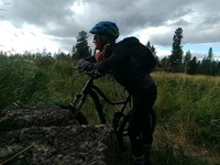
This loop hike around a majority of Palisades Park and Rimrock will give you great views, lovely singletrack, and an up-close experience with the Indian Canyon Waterfall. This route is often overgrown in the summertime and moose frequent this area, so be aware.
Need to Know
This is an urban hiking area. Be aware of transient traffic. It's a city park so no Discover Pass is required. Parking is limited in all the lots around the park, so plan ahead. Spring and summer feature lots of ticks and mosquitoes. Take your bug spray! There have been thefts reported at trailheads in this area, so don't leave anything valuable in your car.
Description
From the parking area, hikers will enter the park on a service road. The waterfall is visible almost from the start if you look into the ravine, but we're saving it for last. A couple hundred feet down the access road, a trail branches off to the left and up the hill. There's a brief, steep climb with exposed roots, loose rocks, and pine needles. At the top of the bluff, the trail goes roughly south, paralleling Bonnie Drive. As the trail begins to veer west, the going gets pretty boggy, even during the driest parts of the summer. Beware of mosquitoes!
Once you've waded through the bog, the trail converges on
Rimrock Drive. Follow the road for several hundred yards until you come to a cut-off on your right. A short, steep scramble will take you to a trail that traverses about halfway up the west side of the canyon/ravine. This section of trail tends to get overgrown in the summer due to lack of use, so long pants are a good idea.
As you hike out of the treeline and into the meadow,
Trail 120 - Indian Meadow Loop meets
Trail 102 - South Trail Green Loop. Take a left (west) at this junction. You'll pass another trail to your right very soon after, but keep going on Trail 102. The trail gets very narrow, rocky, and fairly steep in parts as you head back up to the top of the bluff. Once you've arrived at the top, enjoy some views of downtown Spokane. Then, you'll cross Greenwood Road and take the trail that goes north out of the parking area right along the road.
This area on the top of the bluff is wet most of the year. The grass gets very tall during the summer and the moose bed down for the night in this area. Watch for scat! The trail follows along several fencelines marking private property where you'll see horses and cows.
For a shorter loop, take
Trail 101 that moves off to the east side of the trail, or continue on
Trail 122 - Crater Loop.
Trail 102 - South Trail Green Loop angles northeast and then meets up with an additional junction that goes north and west. That trail gets hard to follow, but staying northeast, the trail is clear and easy to follow. You'll come out on
Rimrock Drive again. Follow the access road south until you come to
Trail 101 again. You'll drop back down the bluff and follow the trail until you get to the railroad tracks. From here, looking west, you can see some of the stone walls the CCC built when this park was brand new.
Trail 101 follows the railroad tracks back to Greenwood Road, where you'll cross the road again and stay on the access road. Right here, if you take a little detour to the right, you'll see a sign back in the trees that says, "Last homesite of Spokane Garry" – an interesting piece of local history.
Take
Trail 104 - Organic Dump Trail to the south (left) and drop down into the ravine where the creek flows. Now you might be in for some bushwhacking. There is a trail that follows the creek bed but it often gets washed out or crowded with logs during seasonal high water. It crosses the creek several times before ending at the foot of the Indian Canyon Waterfall. There's some fun scrambling here with rocky basalt walls.
Once you're done at the falls, retrace your steps a bit until you come to
Trail 107. That will take you out of the ravine and onto
Trail 121 - Waterfall Loop. Go south on
Trail 121 to reconnect to the parking area.
Flora & Fauna
Balsamroot, wild roses, grass widows, moose, cougar, and deer can all be found here.
History & Background
Palisades used to be a traditional city park with playgrounds and a meadow. Many of the stone walls and bridges were built by the CCC. It is the last homesite of Chief Spokane Garry of the Spokane Tribe.
Contacts
Shared By:
Carol Christensen

 Continue with onX Maps
 Continue with Facebook


 Particularly Special Place


 Intermediate

 Long Loop

 Spokane, WA
 Best of the Dishman Hills Natural Area
 Centennial Trail


0 Comments