
 Continue with onX Maps
 Continue with Facebook


 Particularly Special Place


 Difficult
Difficult
Difficult
 Difficult
Land Manager: Land Trust of North AL
 Blevins Gap
11.2 mi 18.0 km • 1,581' Up 481.78 m Up • 1,580' Down 481.54 m Down

 Huntsville, AL
 Hays Preserve Loop
1.9 mi 3.0 km • 20' Up 6.09 m Up • 20' Down 6.17 m Down
 Madkin Mountain Loop
3.8 mi 6.1 km • 222' Up 67.77 m Up • 222' Down 67.76 m Down
 Blackwell Swamp Loop
7.8 mi 12.6 km • 75' Up 22.79 m Up • 74' Down 22.54 m Down
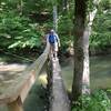
Walls of Jericho
6.7 mi 10.7 km • 1,371' Up 417.73 m Up • 1,370' Down 417.72 m Down
Hytop, AL
Lake Guntersville Loop
3.8 mi 6.1 km • 272' Up 82.82 m Up • 270' Down 82.26 m Down


0 Comments