Hiking Project Logo

A scenic loop around the golf course with great views of the lake.


Your Rating: Rating Rating Rating Rating Rating      Clear Rating
Your Difficulty:
Your Favorites: Add To-Do · Your List
Zoom in to see details
Map Key

3.8

Miles

6.1

KM

Point to Point

1,114' 339 m

High

975' 297 m

Low

272' 83 m

Up

270' 82 m

Down

3%

Avg Grade (2°)

9%

Max Grade (5°)

Dogs Leashed

Features Fall Colors · Views · Wildflowers

Trails are open from sunrise to sunset.

Overview

The Golf Course Loop is a great introduction to Guntersville State Park. With a creek crossing and some of the most rewarding views of Lake Guntersville, this trails give hikers a sense of adventure on a mostly doubletrack loop that is easy to follow.

Description

The Golf Course Loop encircles the Lake Guntersville State Park golf course atop Taylor Mountain. Access to the trail is available at the east end of the Golf Course Parking Lot as well as across the street from the main park Lodge on Lodge Drive.

From the Golf Course parking lot, the trail heads slightly downhill with small berms along the perimeter of the golf course. After about a half-mile, the new trail starts a steady climb followed by a matching descent. Along this stretch hikers will be treated to views of Lake Guntersville.

The trail meanders through wooded areas and areas damaged by the April 2011 tornado outbreak just below the golf course. Except for a few small climbs, the elevation changes are relatively minimal. About halfway through the trail, it crosses a stream. The rock ledge may be slippery, so be careful when hiking across it.

About two-thirds of the way along the trail, it crosses Aubrey Carr Scenic Drive. Watch for traffic as you cross the road. Continue towards the right along the Golf Course Loop (Taylor Mtn comes off on the left), which parallels Aubrey Carr Scenic Drive. At the next trail intersection, turn right. This will take you slightly uphill along the original trail up to Lodge Drive, just across from the park Lodge.

To get back to the Golf Course Parking Lot, hike along the park road back to the parking lot.

Contacts

Shared By:

Kristen Arendt

Trail Ratings

  3.5 from 2 votes

#5126

Overall
  3.5 from 2 votes
5 Star
0%
4 Star
50%
3 Star
50%
2 Star
0%
1 Star
0%
Recommended Route Rankings

#48

in Alabama

#5,126

Overall
3 Views Last Month
406 Since Dec 26, 2019
Easy Easy

100%
0%
0%
0%
0%
0%

Photos

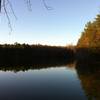
View of Lake Guntersville.
Dec 26, 2019 near Gunters…, AL
View of Lake Guntersville above trees damaged during the April 2011 tornado outbreak.
Oct 6, 2017 near Gunters…, AL
The Golf Course Loop branches off here. The intersection isn't marked, but a right turn will take you up to the Lodge.
Oct 6, 2017 near Gunters…, AL
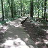
Bridge #2 on the Golf Course Loop. Similar to the first bridge, but it doesn't seem to be quite as slippery.
Oct 6, 2017 near Gunters…, AL
Bridge #1 on Golf Course Loop.
Oct 6, 2017 near Gunters…, AL
Intersection of Golf Course Loop (right) with Taylor Mountain Trail (left).
Oct 6, 2017 near Gunters…, AL

0 Comments

Weather


Current Trail Conditions

Unknown
Add Your Check-In

Check-Ins

Nov 13, 2022
Jill Wood
Welcome

Join the Community! It's FREE

Already have an account? Login to close this notice.