
 Continue with onX Maps
 Continue with Facebook


 Particularly Special Place


 Intermediate/Difficult

 Intermediate/Difficult
Land Manager: USFS - Coconino National Forest Office
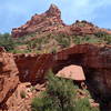
 Mescal Mountain Loop
4.7 mi 7.6 km • 369' Up 112.59 m Up • 369' Down 112.34 m Down
 West Se…, AZ
Long Canyon Out and Back
West Se…, AZ
Long Canyon Out and Back
7.5 mi 12.0 km • 785' Up 239.17 m Up • 784' Down 238.96 m Down
 Bell Rock Trail
1.6 mi 2.7 km • 368' Up 112.26 m Up • 369' Down 112.48 m Down
Village…, AZ
Soldier Pass Trail
3.6 mi 5.8 km • 433' Up 131.84 m Up • 432' Down 131.8 m Down
Sedona, AZ
 Ground Control to Major Tom
3.8 mi 6.0 km • 357' Up 108.72 m Up • 356' Down 108.47 m Down
Boynton Canyon Trail Out and Back
6.0 mi 9.6 km • 585' Up 178.37 m Up • 585' Down 178.38 m Down
West Se…, AZ


 All Clear


0 Comments