
 Continue with onX Maps
 Continue with Facebook


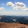
 Particularly Special Place


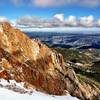
 Difficult
Difficult
Difficult
 Difficult
Land Manager: USFS - Pikes Peak Ranger District
 Barr Camp Out-and-Back
13.5 mi 21.7 km • 3,619' Up 1103.22 m Up • 3,619' Down 1102.95 m Down

 Manitou…, CO
 Heizer Trail to Manitou Reservoir
6.9 mi 11.1 km • 2,477' Up 755.07 m Up • 2,477' Down 755.02 m Down
Section 16 to Jones Park (and back) Mountain Ramble
17.6 mi 28.4 km • 4,025' Up 1226.79 m Up • 4,024' Down 1226.65 m Down
 Mays Peak Lollipop
3.6 mi 5.8 km • 803' Up 244.84 m Up • 796' Down 242.64 m Down
 Monument Valley Park Loop
4.3 mi 7.0 km • 87' Up 26.64 m Up • 85' Down 25.98 m Down
Pikes Peak Northwest Slopes
6.6 mi 10.6 km • 4,123' Up 1256.58 m Up • 27' Down 8.28 m Down
Cascade…, CO


0 Comments