
 Continue with onX Maps
 Continue with Facebook


 Particularly Special Place


 Easy/Intermediate
Easy/Intermediate
Easy/Intermediate
 Easy/Intermediate
Local Club: Yellowstone Forever
Apr 15, 2024: Naturalist Notes: Spring into Yellowstone
Mar 20, 2024: 10 Signs Spring Has Sprung in Yellowstone
Mar 18, 2024: Plan Your Spring Trip to Yellowstone
Land Manager: National Park Service - Yellowstone National Park
 Bechler Canyon
31.6 mi 50.9 km • 1,408' Up 429.16 m Up • 2,766' Down 843.04 m Down
 Old Fai…, WY
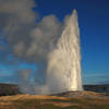
 Observation Point-Geyser Hill
2.3 mi 3.6 km • 258' Up 78.53 m Up • 257' Down 78.44 m Down
Purple Mountain
6.8 mi 11.0 km • 1,570' Up 478.47 m Up • 1,570' Down 478.42 m Down
Monument Geyser Basin
2.7 mi 4.4 km • 676' Up 206.17 m Up • 677' Down 206.2 m Down
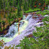
 Terraced Falls
3.9 mi 6.2 km • 361' Up 110.13 m Up • 362' Down 110.24 m Down
 Yellows…, WY
 Seven Mile Hole-Washburn Hot Springs
13.3 mi 21.4 km • 2,016' Up 614.54 m Up • 2,017' Down 614.72 m Down
Canyon…, WY


1 Comment