
 Continue with onX Maps
 Continue with Facebook


 Particularly Special Place


 Intermediate
Intermediate
Intermediate
 Intermediate
Land Manager: Pacific Northwest Trail Association
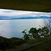
 Mount Erie Summit
3.6 mi 5.8 km • 1,073' Up 326.98 m Up • 1,073' Down 326.9 m Down
 Anacortes, WA
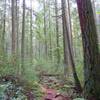
 Main Line Loop
5.1 mi 8.3 km • 487' Up 148.35 m Up • 487' Down 148.33 m Down
Camano Island Ridge Forest Preserve Loop
2.7 mi 4.4 km • 222' Up 67.54 m Up • 219' Down 66.9 m Down
Camano, WA
 Mt. Finlayson - Lagoon Loop
3.8 mi 6.2 km • 422' Up 128.62 m Up • 423' Down 128.97 m Down
Barnum Point Preserve Loop Trail
1.9 mi 3.0 km • 145' Up 44.31 m Up • 160' Down 48.7 m Down
Camano, WA
 Pacific Northwest National Scenic Trail: Oyster Dome-Deception Pass
37.8 mi 60.9 km • 1,266' Up 385.84 m Up • 1,299' Down 396 m Down
Bow, WA


 Minor Issues


0 Comments