Continue with onX Maps
 Sign in with Facebook


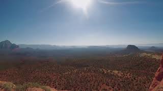
Central AZ
 AZ
AZ- Central AZ


Gems in Central AZ - 5
Hiking Project is built by hikers like you. Add Your Gems


Recommended Routes in Central AZ - 29
Hiking Project is built by hikers like you. Add Your Recommended Routes


 Intermediate/Difficult
Peralta Out and Back
4.5 mi 7.2 km • 1,338' Up 407.81 m Up • 1,337' Down 407.66 m Down

 Gold Camp, AZ
 Difficult
Weavers Needle Loop
12.7 mi 20.4 km • 2,643' Up 805.52 m Up • 2,637' Down 803.87 m Down
Gold Camp, AZ
 Difficult
Fossil Springs Trail
8.7 mi 14.0 km • 1,426' Up 434.7 m Up • 1,426' Down 434.76 m Down
Pine, AZ
 Intermediate/Difficult
Miners Needle Loop
9.3 mi 14.9 km • 1,297' Up 395.23 m Up • 1,301' Down 396.42 m Down
Gold Camp, AZ
 Difficult
Picket Post Mountain Trail
4.3 mi 7.0 km • 1,957' Up 596.36 m Up • 1,957' Down 596.36 m Down
Superior, AZ
 Difficult
Four Peaks
12.4 mi 19.9 km • 2,074' Up 632.12 m Up • 2,074' Down 632.16 m Down
Tonto B…, AZ
 Intermediate/Difficult
Granite Mountain Trail #261
7.9 mi 12.7 km • 1,559' Up 475.16 m Up • 1,559' Down 475.07 m Down
Williamson, AZ


Central AZ Hiking
- 2,899 Miles 4,665 Kilometers of Trail
- 29 Recommended Routes
- 5 Gems

- 275
Easy Trails

- 357
Intermediate Trails

- 199
Difficult Trails

Areas Within Central AZ
Weather Averages
|
High
|
Low
|
Precip
|
Days w/
|
| J | F | M | A | M | J | J | A | S | O | N | D |
Trails in Central AZ - 802
Hiking Project is built by hikers like you. Add Your Trails
|
4.1
mi
6.6
km
#1Crack in the Mountain Trail
Intermediate/Difficult
Lake Havasu City, AZ
|
Intermediate/Difficult
|
Lake Havasu City, AZ |
12
|
|
2.7
mi
4.3
km
#2Cibecue Creek Trail
 Intermediate
Cibecue, AZ
|
Intermediate
|
Cibecue, AZ |
11
|
|
|
6.2
mi
10.0
km
#3Peralta Canyon Trail
Intermediate/Difficult
Gold Camp, AZ
|
Intermediate/Difficult
|
Gold Camp, AZ |
15
|
|
|
26.1
mi
42.0
km
#4AZT - Passage 16 - Gila River Canyons
Intermediate/Difficult
Kearny, AZ
|
Intermediate/Difficult
|
Kearny, AZ |
3
|
|
3.0
mi
4.8
km
#5Lynx Lake Trail #0311
 Easy/Intermediate
Prescott, AZ
|
Easy/Intermediate
|
Prescott, AZ |
3
|
|
|
2.7
mi
4.4
km
#6Butcher Jones Trail #463
Intermediate
Apache Junction, AZ
|
Intermediate
|
Apache Junction, AZ |
12
|
|
|
8.7
mi
14.0
km
#7Land of the Pioneers
Intermediate
Pinetop-Lakeside, AZ
|
Intermediate
|
Pinetop-Lakeside, AZ |
2
|
|
2.5
mi
4.0
km
#8Thompson Trail #629
 Easy
Easy
Eagar, AZ
|
Easy
|
Eagar, AZ |
2
|
|
|
8.3
mi
13.4
km
#9West Baldy Trail #94B
Intermediate
Eagar, AZ
|
Intermediate
|
Eagar, AZ |
2
|
|
|
14.0
mi
22.6
km
#10AZT - Passage 24 - Red Hills
Difficult
Payson, AZ
|
Difficult
|
Payson, AZ |
2
|
Photos of Central AZ - 1,309
Hiking Project is built by hikers like you. Add Your Photos