Continue with onX Maps
 Sign in with Facebook


 Particularly Special Place


Apache Sitgreaves National Forest
 AZ
AZ- Central AZ
- Apache Sitgreaves National Forest


Recommended Routes in Apache Sitgreaves National Forest - 1
Hiking Project is built by hikers like you. Add Your Recommended Routes


Apache Sitgreaves National Forest Hiking
- 1,200 Miles 1,932 Kilometers of Trail
- 1 Recommended Route
- 143
Easy Trails

- 102
Intermediate Trails

- 65
Difficult Trails

Hiking Project is built by hikers like you. Share
what you know about this area!
Areas Within Apache Sitgreaves National Forest
Weather Averages
|
High
|
Low
|
Precip
|
Days w/
|
| J | F | M | A | M | J | J | A | S | O | N | D |
Trails in Apache Sitgreaves National Forest - 309
Hiking Project is built by hikers like you. Add Your Trails
8.7
mi
14.0
km
#1Land of the Pioneers
 Intermediate
Pinetop-Lakeside, AZ

|
Intermediate
|
Pinetop-Lakeside, AZ |
2
|
|
2.5
mi
4.0
km
#2Thompson Trail #629
 Easy
Easy
Eagar, AZ
|
Easy
|
Eagar, AZ |
2
|
|
|
8.3
mi
13.4
km
#3West Baldy Trail #94B
Intermediate
Eagar, AZ
|
Intermediate
|
Eagar, AZ |
2
|
|
11.7
mi
18.9
km
#4Horse Canyon Trail #36
 Difficult
Clifton, AZ
|
Difficult
|
Clifton, AZ |
2
|
|
|
13.9
mi
22.4
km
#5Los Burros
Intermediate
Pinetop-Lakeside, AZ
|
Intermediate
|
Pinetop-Lakeside, AZ |
1
|
|
|
2.3
mi
3.6
km
#6Flat Top Trail #607E
Intermediate
Eagar, AZ
|
Intermediate
|
Eagar, AZ |
1
|
|
|
0.9
mi
1.5
km
#7Telephone Ridge Trail #203
Difficult
Heber-Overgaard, AZ
|
Difficult
|
Heber-Overgaard, AZ |
1
|
|
|
0.8
mi
1.4
km
#8Bear Creek Trail #66
Intermediate
Eagar, AZ
|
Intermediate
|
Eagar, AZ |
1
|
|
|
2.0
mi
3.3
km
#9Los Burros Shortcut
Intermediate
Pinetop-Lakeside, AZ
|
Intermediate
|
Pinetop-Lakeside, AZ |
1
|
|
4.9
mi
7.9
km
#10Aker Lake Trail #17
 Easy/Intermediate
Eagar, AZ
|
Easy/Intermediate
|
Eagar, AZ |
1
|
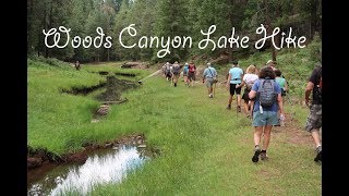
Photos of Apache Sitgreaves National Forest - 44
Hiking Project is built by hikers like you. Add Your Photos