
 Continue with onX Maps
 Sign in with Facebook


 Particularly Special Place


Mazatzal Wilderness
 AZ
AZ- Central AZ
- Mazatzal Wilderness


Trails in Mazatzal Wilderness - 13
Hiking Project is built by hikers like you. Add Your Trails
14.0
mi
22.6
km
#1AZT - Passage 24 - Red Hills
 Difficult
Payson, AZ

|
Difficult
|
Payson, AZ |
2
|
|
|
17.5
mi
28.1
km
#2Davenport Trail #89
Difficult
Payson, AZ
|
Difficult
|
Payson, AZ |
1
|
|
17.6
mi
28.4
km
#3Willow Springs Trail #223
 Intermediate/Difficult
Payson, AZ
|
Intermediate/Difficult
|
Payson, AZ |
1
|
|
10.9
mi
17.5
km
#4Dutchman Grave Trail #22
 Intermediate
Payson, AZ
|
Intermediate
|
Payson, AZ |
1
|
|
|
4.0
mi
6.4
km
#5Bull Spring Trail #34
Intermediate
Payson, AZ
|
Intermediate
|
Payson, AZ |
1
|
|
|
10.6
mi
17.0
km
#6Wet Bottom Trail #269
Intermediate
Payson, AZ
|
Intermediate
|
Payson, AZ |
1
|
|
|
4.7
mi
7.5
km
#7Highwater Trail #20
Intermediate
Payson, AZ
|
Intermediate
|
Payson, AZ |
1
|
|
|
5.9
mi
9.5
km
#8Dead Man Trail #25
Difficult
Payson, AZ
|
Difficult
|
Payson, AZ |
1
|
|
|
4.7
mi
7.5
km
#9Brush Trail #249
Intermediate/Difficult
Payson, AZ
|
Intermediate/Difficult
|
Payson, AZ |
1
|
|
|
14.6
mi
23.5
km
#10Red Hills Trail #262
Intermediate
Payson, AZ
|
Intermediate
|
Payson, AZ |
1
|
|
|
2.4
mi
3.9
km
#11Midnight Trail #272
Intermediate/Difficult
Payson, AZ
|
Intermediate/Difficult
|
Payson, AZ |
1
|
|
|
5.6
mi
9.0
km
#12Y Bar Trail #44
Difficult
Payson, AZ
|
Difficult
|
Payson, AZ |
1
|
|
|
11.3
mi
18.2
km
#13AZT - Passage 25 - Whiterock Mesa
Intermediate
Payson, AZ
|
Intermediate
|
Payson, AZ |
0
|
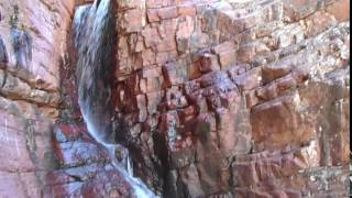
Photos of Mazatzal Wilderness - 18
Hiking Project is built by hikers like you. Add Your Photos


Mazatzal Wilderness Hiking
- 124 Miles 199 Kilometers of Trail
- 0 Recommended Routes
- 0
Easy Trails

- 9
Intermediate Trails

- 4
Difficult Trails

Hiking Project is built by hikers like you. Share
what you know about this area!
Weather Averages
|
High
|
Low
|
Precip
|
Days w/
|
| J | F | M | A | M | J | J | A | S | O | N | D |

