
Local Club: Trails Club of Oregon (TCO)
Jul 29, 2023: August 2023 Trail Blazer
Jun 28, 2023: July 2023 Trail Blazer
May 29, 2023: June 2023 Trail Blazer
Land Manager: USFS - Mt. Hood National Forest - Hood River Ranger District
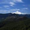
 PCT: Herman Creek to Eagle Benson
18.1 mi 29.1 km • 4,399' Up 1340.93 m Up • 4,399' Down 1340.8 m Down

 Cascade…, OR
 Dry Creek Falls
4.4 mi 7.1 km • 734' Up 223.66 m Up • 734' Down 223.58 m Down
HCRHT: Twin Tunnels Trail
9.5 mi 15.3 km • 650' Up 198.1 m Up • 650' Down 198.1 m Down
 Eagle Creek Trail to Tunnel Falls
11.7 mi 18.8 km • 1,280' Up 390.28 m Up • 1,280' Down 390.29 m Down
Cascade…, OR
Catherine Creek
2.5 mi 4.1 km • 752' Up 229.1 m Up • 751' Down 228.87 m Down
Elowah Falls
1.4 mi 2.2 km • 255' Up 77.59 m Up • 253' Down 77.13 m Down
Cascade…, OR

 Continue with onX Maps
 Continue with Facebook


 Particularly Special Place


 Minor Issues


0 Comments