Hiking Project Logo

An fairly easy hike up the PCT to 360 degree views from an old fire tower location (minor scramble at the very end)


Your Rating: Rating Rating Rating Rating Rating      Clear Rating
Your Difficulty:
Your Favorites: Add To-Do · Your List
Zoom in to see details
Map Key

4.0

Miles

6.4

KM

Out and Back

3,503' 1,068 m

High

2,359' 719 m

Low

1,144' 349 m

Up

1,143' 348 m

Down

11%

Avg Grade (6°)

21%

Max Grade (12°)

Dogs Leashed

Features Views · Wildflowers · Wildlife

Family Friendly The final scramble onto the rock pyramid isn't but the rest of this trail is family friendly and still worth the trip out.

Overview

This hike will mostly take place on the PCT so the trail is usually in excellent condition. A short side trail takes you to a open summit with summer wildflowers and a cool basalt pyramid that offers excellent 360 degree views. However, a very short and easy scramble is required to get to the top and radio towers do tarnish the view south towards Mt. Hood.

Description

There is a parking area on road 2090 just a few hundred feet from Red Bluff Road/RD2000. Although these roads are dirt they should be passable in any car most of the time.

The PCT clearly crosses the road near the eastern edge of the parking area. Take it to the south to begin a nice moderate climb up, assisted by a few wide switchbacks. Much of this part of the forest was burned in 1902 so don't expect old growth, but the forest is lovely enough. At about a mile you'll encounter a nice viewpoint from an exposed cliff. After about 1.3 miles the trail levels off a bit and you'll come to an intersection with a trail on your right leading west. Take this trail which passes a water trough filled from a piped spring. You'll come to an old heavily eroded road which you should take west (right). The road takes you to the wide-open summit of Three Corner Rock. To the south a radio tower stands, partially blocking the best views of Mount Hood while to your north stands a pile of basalt forming roughly a pyramid. This is your target.

Follow the path to the base of the basalt rock spire and pick up the old concrete pathway poured into the rocks that once lead to a fire tower. A mix of this concrete path and some rock stairs winds most of the way up the southern and eastern side of the basalt tower. However, the last perhaps ten feet will require minor scrambling. On the true summit not much remains of the tower other than some foundation rocks. The top itself consists of large rocks without a flat area, so you'll have to choose your footing carefully as you enjoy fantastic 360 degree views that rival Silver Star, but without the crowds (but it's still popular, don't expect solitude).

Note, if you want to make this hike a little longer and have part of it be even less crowded, you can park along RD2000 where the PCT crosses it. This will add about 4 miles round trip and another about 700 feet of gain. There isn't a major reason to do this other than to have a longer day out on the PCT!

Contacts

Shared By:

Karl W

Trail Ratings

  4.0 from 1 vote

#4484

Overall
  4.0 from 1 vote
5 Star
0%
4 Star
100%
3 Star
0%
2 Star
0%
1 Star
0%
Recommended Route Rankings

#220

in Washington

#4,484

Overall
2 Views Last Month
66 Since Nov 23, 2021
Intermediate Intermediate

0%
0%
100%
0%
0%
0%

Photos

The radio tower and Mount Hood from the top of Three Corner Rock.
Nov 26, 2021 near Stevenson, WA
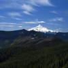
View from the cliff.
Aug 16, 2016 near Stevenson, WA

0 Comments

Weather


Current Trail Conditions

Unknown
Add Your Check-In

Check-Ins

none
Welcome

Join the Community

Create your FREE account today!
Already have an account? Login to close this notice.

Get Started