Hiking Project Logo

A great loop option up Silver Star that adds in Sturgeon Rock for extra views.


Your Rating: Rating Rating Rating Rating Rating      Clear Rating
Your Difficulty:
Your Favorites: Add To-Do · Your List
Zoom in to see details
Map Key

8.7

Miles

14.0

KM

Loop

4,338' 1,322 m

High

2,390' 729 m

Low

2,273' 693 m

Up

2,266' 691 m

Down

10%

Avg Grade (6°)

30%

Max Grade (17°)

Dogs Leashed

Features Geological Significance · River/Creek · Views · Wildflowers

Overview

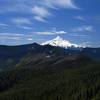
This loop takes a while to get going, but offers great views that few people experience -- better than the two more standard ways up Silver Star. You'll have over half of this route mostly to yourself. Overall, this loop is easy to do along a mix of singletrack and rocky forest road-like trails, aside from the short scramble up Sturgeon Rock. You'll get to see St. Helens, Hood, Rainier, and Adams on decent days, and even Jefferson and the Sisters if you squint on clear days.

Need to Know

Parking at Grouse Vista Trailhead requires a Washington Discovery Pass.

Description

Parking for this loop is available at Grouse Vista Trailhead on L-1200, a rocky dirt road that should be navigable for any low clearance vehicle. This is a popular trailhead because most vehicles can get to it - unlike the shortest and easiest route to Silver Star Summit from the north off of NF-4019 - and the Grouse Vista 180F trail (AKA Pyramid Trail) is a very popular out-and-back.

Begin hiking north and you'll come to a very obvious fork with the Tarbell Trail, which you should take to the left. This singletrack trail is popular with mountain bikers. At about 1.75 miles, you'll come to Rock Creek Falls, which is nothing special (but the bridge is nice). Thereafter, you'll begin to climb through a region that was very recently logged (early 2019?). The logging roads can make the trail a little confusing to follow, so bring along Hiking Project for help. You need to cross the roads a few times, but should never need to hike on the roads themselves.

At just shy of 3 miles, you'll need to look for Sturgeon 180C, an unmarked but fairly clear doubletrack trail that heads east from Tarbell Trail. You'll be on a bank above a new logging trail when you come to this intersection. Sturgeon 180C begins slogging straight up, but it is at least out of the logging areas.

Finally you'll come to a level clearing with evidence of a fire circle. Look for faint doubletrack in the grass on the north side. This leads you to the Sturgeon Rock "trail." This is when the loop goes from "okay" to "great." You'll need to scramble a bit to get onto the shoulder of the rock, but after the scramble the route is easy (be mindful of the steep edges though). You'll get amazing views of the four nearby volcanoes, wildflowers, Pyramid Rock, and the crowded summit of Silver Star. Moreover, you'll likely have Sturgeon Rock to yourself!

Retrace your route back to Sturgeon 180C trail - there is a small spur that is easy to spot when you get back to the scramble that can save some backtracking. To make this more of a loop and to get a few views of the interesting volcanic columns that make up Sturgeon Rock, take the unmarked but fairly obvious spur to the north, right at the eastern end of the rock. This will drop you out at the intersection of Silver Star Trail #180 and Ed's Trail #180A.

Head south (right) and follow the obvious wide rocky road that is Silver Star Trail #180 to another obvious (but unsigned) intersection with Silver Star Summit Trail #180D. This is also a wide rocky road/trail, and will be crowded. This takes you right up to Silver Star Summit without any obstacles. Enjoy the fantastic views - including down to Sturgeon Rock!

Might as well hop up the secondary summit spur trail for a few more views while you're here.

Retrace your steps down Silver Star Summit Trail #180D but turn south (left) onto Silver Star Trail #180. Follow this a short distance to Grouse Vista #180F (AKA Pyramid Trail) and head south (right). The first section on this trail is loose rock, so be careful. Eventually this trail opens up and offers beautiful views of Pyramid Rock and Sturgeon Rock, with okay views of Silver Star Summit if you look behind you. It lacks good views of the Cascade Volcanoes, though. Follow this trail all the way, pass Tarbell Trail, and arrive back at the trailhead.

Flora & Fauna

Over 100 types of wildflowers have been documented on Silver Star.

History & Background

The awesome views you get from this trail are in part because of the massive fire 1902 Yacolt Burn which destroyed ~240,000 acres. The forest has yet to recover near the summit, so no trees block your view and wildflowers abound. You'll see the foundation of a fire tower that was put up in 1952 and removed in 1969 on the higher summit.

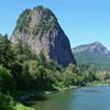
Sturgeon Rock is a basaltic monolith that has been exposed by erosion and gets its name from its fin-like appearance when viewed from Silver Star Summit.

Contacts

Shared By:

Karl W

Trail Ratings

  4.3 from 4 votes

#3609

Overall
  4.3 from 4 votes
5 Star
50%
4 Star
25%
3 Star
25%
2 Star
0%
1 Star
0%
Recommended Route Rankings

#236

in Washington

#3,609

Overall
17 Views Last Month
1,779 Since Jul 13, 2019
Intermediate/Difficult Intermediate/Difficult

0%
0%
25%
25%
50%
0%

Photos

Mount St Helens behind Silver Star
May 2, 2021 near Venersborg, WA
Little Baldy (foreground) and Mount Hood (horizon) from Silver Star Mountain
Dec 15, 2017 near Venersborg, WA
Video review of the Silver Star Summit Hike with footage of it's features and terrain.
Aug 9, 2023 near Venersborg, WA
Mt Hood from Sturgeon Rock
Jul 13, 2019 near Venersborg, WA
Adams is also clearly visible from Sturgeon Rock
Jul 13, 2019 near Venersborg, WA
The summit of Silver Star Mountain with Mt. St. Helens on the horizon
Dec 16, 2017 near Venersborg, WA

0 Comments

Weather


Current Trail Conditions

Unknown
Add Your Check-In

Check-Ins

Jun 10, 2023
Shawneen Gonzalez
8.7mi — 7h 36m
Oct 16, 2021
Mark H
May 1, 2021
John R
Jun 2, 2020
Tanner Baloh
Challenging but not too strenuous.
May 11, 2020
Shelby Saylors
8.1mi
Aug 12, 2019
Steve Heller
2 miles out and back southbound on Tarbell to warm up, then attempted this hike until trail closure, then backtrack to summit Silver Star and return. 12.5mi — 3h 40m
Jun 15, 2019
Karl W
Welcome

Join the Community! It's FREE

Already have an account? Login to close this notice.