
 Continue with onX Maps
 Continue with Facebook


 Particularly Special Place


 Intermediate

 Intermediate
Land Manager: San Mateo County Department of Parks
 Creeks to Peaks Trail
3.6 mi 5.9 km • 729' Up 222.24 m Up • 729' Down 222.12 m Down
Daly City, CA
Mussel Rock Park Tour
2.2 mi 3.6 km • 310' Up 94.64 m Up • 310' Down 94.47 m Down
 Broadmoor, CA
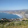
Pedro Point Headlands Loop
Broadmoor, CA
Pedro Point Headlands Loop
2.3 mi 3.7 km • 481' Up 146.73 m Up • 481' Down 146.51 m Down
Pacifica, CA
 Devil's Slide Trail
2.5 mi 4.1 km • 269' Up 82.1 m Up • 269' Down 81.88 m Down
Pacifica, CA
 Mt. Livermore Summit - North Ridge Trail
4.3 mi 6.9 km • 784' Up 239.03 m Up • 783' Down 238.68 m Down
Tiburon, CA
South Headlands Loop (Coast-Miwok-Alta)
7.8 mi 12.6 km • 1,243' Up 378.86 m Up • 1,239' Down 377.52 m Down
Sausalito, CA


0 Comments