Hiking Project Logo

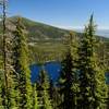
A departure from the Pacific Crest Trail for views from Porcupine Mountain.


Your Rating: Rating Rating Rating Rating Rating      Clear Rating
Your Difficulty:
Your Favorites: Add To-Do · Your List
Zoom in to see details
Map Key

0.7

Miles

1.1

KM

Point to Point

5,225' 1,593 m

High

4,987' 1,520 m

Low

235' 72 m

Up

238' 73 m

Down

14%

Avg Grade (8°)

32%

Max Grade (18°)

Dogs Off-leash

Features Views · Wildflowers

This spur trail is accessible via the Pacific Crest Trail from the Pilot Rock Trail to the west or the Boccard Point Trail to the east. Its western end can also be reached via gravel forest roads starting from the Pilot Rock Trail. This trail may be inaccessible between November and April due to snow or ice.

Need to Know

Porcupine Mountain sits in the Cascade-Siskiyou National Monument just outside the northern boundary of the Soda Mountain Wilderness. No permits or fees are required here.

Description

Porcupine Mountain is the named summit of a ridge that protrudes north from the Siskiyou Crest about 1.3 miles east of Pilot Rock. From its summit, there are views of Soda Mountain to the east, Mount Shasta to the south, Mount Ashland to the west, and Mount McLoughlin to the north.

It makes a good destination for a hike starting from either the west or the east and a nice viewpoint for those transiting along the PCT: Highway 5 to Highway 140 (near Fish Lake).

Coming from the west along the PCT, you'll come very close to a gravel road 1.5 miles from the turn-off to Pilot Rock. Leave the PCT here, cross the gravel road, and look for an old road directly on the other side. This old road was aggressively decommissioned a few years ago but a use trail has now developed along its prism.

Continue uphill to where the old road crests the ridge, then turn north and follow along the top of the ridge, through a few trees, to Porcupine's open summit. A use trail is becoming evident along this ridge.

Coming from the east along the PCT, you'll pass a junction with the Lone Pilot Trail and, at 2.4 miles, reach a saddle where a faint old road climbs to the north. Follow this road up to the crest of the ridge, where is connects with the route coming up from the west.

It's all the same old road but this eastern half was not decommissioned like the western half. Follow the ridge to the summit. This way to Porcupine is longer but offers spectacular views (weather permitting) of Mount Shasta to the south.

Contacts

Shared By:

BK Hope

Trail Ratings

  3.0 from 1 vote

#32084

Overall
  3.0 from 1 vote
5 Star
0%
4 Star
0%
3 Star
100%
2 Star
0%
1 Star
0%
Trail Rankings

#1,086

in Oregon

#32,084

Overall
2 Views Last Month
93 Since Feb 18, 2021
Intermediate Intermediate

0%
0%
100%
0%
0%
0%

Photos

Mount Shasta from the PCT east of Porcupine Mountain.
Feb 18, 2021 near Ashland, OR

0 Comments

Weather


Current Trail Conditions

Unknown
Add Your Check-In

Check-Ins

Apr 9, 2022
BK Hope
Nov 17, 2021
BK Hope
May 7, 2020
BK Hope
Oct 21, 2018
BK Hope
Dec 11, 2017
BK Hope
Welcome

Join the Community

Create your FREE account today!
Already have an account? Login to close this notice.

Get Started