
 Continue with onX Maps
 Continue with Facebook


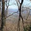
 Particularly Special Place


 Difficult
Difficult
Difficult
 Difficult
Local Club: Georgia Appalachian Trail Club (GATC)
Land Manager: USFS - Chattahoochee-Oconee National Forest
 Woody Gap and Dockerty Lake Loop
20.3 mi 32.7 km • 3,301' Up 1006.11 m Up • 3,299' Down 1005.42 m Down

 Dahlonega, GA
 Long Creek Falls
2.0 mi 3.2 km • 264' Up 80.42 m Up • 264' Down 80.39 m Down
Fall Branch Falls Out-and-Back
0.9 mi 1.5 km • 207' Up 63.23 m Up • 206' Down 62.66 m Down
Cherry Log, GA
 Weaver Creek to Rocky Mountain
6.7 mi 10.8 km • 1,525' Up 464.71 m Up • 1,525' Down 464.68 m Down
Denton Creek Falls
2.0 mi 3.2 km • 482' Up 146.96 m Up • 482' Down 146.85 m Down
Hiawassee, GA
Beech Creek Trail to Big Scaly Mountain
9.9 mi 15.9 km • 2,649' Up 807.37 m Up • 2,650' Down 807.68 m Down


1 Comment