
 Continue with onX Maps
 Continue with Facebook


 Particularly Special Place


 Intermediate
Intermediate
Intermediate
 Intermediate
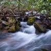
 Anna Ruby Falls Trail #15
1.0 mi 1.5 km • 221' Up 67.38 m Up • 221' Down 67.25 m Down

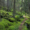
 Blood Mountain Loop
6.6 mi 10.6 km • 1,424' Up 434.06 m Up • 1,422' Down 433.4 m Down
 Blairsv…, GA
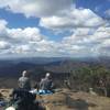
 Springer Mountain
8.8 mi 14.1 km • 1,315' Up 400.93 m Up • 1,316' Down 401.1 m Down
Ellijay, GA
 Beech Creek Trail to Big Scaly Mountain
9.9 mi 15.9 km • 2,649' Up 807.37 m Up • 2,650' Down 807.68 m Down
Benton MacKaye Trail
287.2 mi 462.3 km • 53,404' Up 16277.4 m Up • 55,479' Down 16910.1 m Down
Dahlonega, GA
Standing Indian (Nantahala Headwaters) Loop
21.9 mi 35.3 km • 3,960' Up 1206.92 m Up • 3,972' Down 1210.8 m Down
Franklin, NC


0 Comments