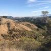
Land Manager: California State Parks - Mount Diablo State Park
 Mount Diablo Falls Loop
5.4 mi 8.7 km • 1,108' Up 337.87 m Up • 1,106' Down 337.13 m Down


 Clayton, CA
 Mt. Diablo Summit Loop - South
16.0 mi 25.8 km • 3,679' Up 1121.47 m Up • 3,678' Down 1121.12 m Down


 Diablo, CA
 Eagle Peak Out and Back
4.2 mi 6.8 km • 1,435' Up 437.34 m Up • 1,434' Down 437.22 m Down


 Alamo, CA
 Miwok Trail / Hardy Canyon Trail Loop
4.8 mi 7.7 km • 955' Up 290.95 m Up • 954' Down 290.83 m Down


 Byron, CA
 Elderberry - Rocky View - Cuestas Loop
8.1 mi 13.1 km • 1,397' Up 425.89 m Up • 1,396' Down 425.64 m Down


 Danville, CA
 Rim Trail
5.2 mi 8.3 km • 903' Up 275.09 m Up • 901' Down 274.55 m Down


 Lafayette, CA


0 Comments