Hiking Project Logo

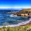
A winding singletrack summiting Hazard Peak with great views along the way.


Your Rating: Rating Rating Rating Rating Rating      Clear Rating
Your Difficulty:
Your Favorites: Add To-Do · Your List
Zoom in to see details
Map Key

4.2

Miles

6.8

KM

Point to Point

1,079' 329 m

High

132' 40 m

Low

948' 289 m

Up

336' 102 m

Down

6%

Avg Grade (3°)

15%

Max Grade (8°)

Dogs Leashed

Features Views

Description

From San Luis Obispo, take Los Osos Valley Road into Los Osos. The road turns into Pecho Valley Road, begins to parallel the ocean, and becomes narrow and winding. Park at Hazard Peak Trailhead (parking area is on the right). If that lot is full, park at Spooner's Cove about .25 miles down the road.

The trail is built for mountain bikers so it is very smooth and flowing with cinder block lattice structures at the sharper turns. The grade is consistently moderate, not exceeding 350ft/mile for any given segment. After a mile, there is a 3-way intersection with Hiedra Trail; take a right and continue on Hazard Peak Trail.

Hazard Peak is at mile three and offers great views of the ocean and Moro Bay. From here, the trail gets rockier, steeper and descends for a mile until the intersection with the Manzanita Trail. Hook a right and continue for another .1 miles until the trail terminates at the East Boundary Trail.

From the termination of Hazard Peak Trail you could continue right onto East Boundary Trail, connect to Islay Creek Road and that gives you a 9-ish mile loop...alternatively, you can continue left until the intersection with Hazard Canyon Road and make a loop that way.

Contacts

Shared By:

Chris Fa

Trail Ratings

  3.8 from 5 votes

#15457

Overall
  3.8 from 5 votes
5 Star
20%
4 Star
40%
3 Star
40%
2 Star
0%
1 Star
0%
Trail Rankings

#1,609

in California

#15,457

Overall
4 Views Last Month
841 Since Feb 11, 2017
Intermediate Intermediate

0%
20%
80%
0%
0%
0%
loading

Weather


Current Trail Conditions

Unknown
Add Your Check-In

Check-Ins

Aug 3, 2021
Peder Bisbjerg
I was a little troubled by the fact that 'no trespassing" signs prevented a larger loop going further north. 9.8mi — 4h 30m
Mar 30, 2018
Amanda Camelo
Welcome

Join the Community

Create your FREE account today!
Already have an account? Login to close this notice.

Get Started