
 Continue with onX Maps
 Continue with Facebook


 Particularly Special Place


 Intermediate
Intermediate
Intermediate
 Intermediate
 Mount Mitchell
11.7 mi 18.8 km • 3,651' Up 1112.72 m Up • 3,650' Down 1112.62 m Down

 Black M…, NC
 Gateway Trails
7.5 mi 12.0 km • 942' Up 287.01 m Up • 941' Down 286.84 m Down
 Fonta Flora Trail Loop
6.9 mi 11.0 km • 427' Up 130.07 m Up • 426' Down 129.87 m Down
Glen Al…, NC
AT: Carver's Gap to US19E
14.2 mi 22.9 km • 1,808' Up 551.09 m Up • 4,403' Down 1341.95 m Down
Roan Mo…, TN
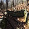
Rattlesnake Lodge Loop
4.0 mi 6.5 km • 847' Up 258.17 m Up • 847' Down 258.18 m Down
 The Raiders of the Pines Fitness Loop
13.3 mi 21.4 km • 2,217' Up 675.84 m Up • 2,231' Down 680.1 m Down


0 Comments