Hiking Project Logo

A hike that is just a mixed bag of all types of terrain (gravel, dirt road, singletrack) with great views along the way.


Your Rating: Rating Rating Rating Rating Rating      Clear Rating
Your Difficulty:
Your Favorites: Add To-Do · Your List
Zoom in to see details
Map Key

7.4

Miles

11.8

KM

Loop

2,471' 753 m

High

1,261' 384 m

Low

1,648' 502 m

Up

1,637' 499 m

Down

8%

Avg Grade (5°)

38%

Max Grade (21°)

Dogs Unknown

Features Birding · Cave · Fall Colors · River/Creek · Spring · Views · Wildflowers · Wildlife

Overview

Basically, just grind up a pristine gravel road as hard as you can, enjoy the views of the gorge along some doubletrack, watch out for 20 ft deep sinkholes, and try not to slide down a cliff while descending some amazing benched singletrack! This hike is 7.4 miles of awesomeness!

Need to Know

This is also a very popular mountain bike loop, so be on the lookout so you don't get run over.

Description

Directions to start: From Morganton, head up NC 181 north towards Linville. After mile marker 17, look for a gravel road on the right, which is Craig Creek Rd (FS 982). Follow this gravel road for about another 1.5 miles and pull off at a gated road (FS 986) on the right. There is space for a couple of cars here, and you should see it shortly after going over a bridge on the road.

From here, the challenge includes hiking up FS 982 to FS 4099. From FS 982 turn right onto Little Chestnut Mountain Road (FS 4099) and follow it to Holly Springs Trail #273. There is a US Forestry sign pointing out the sinkhole (Holly Springs Trail #273) trail to the right. Take this trail (blue-blazed) and follow it back to the car.

The first section of the Holly Springs Trail #273 is along the ridgeline and is steep, technical, and has started to get a bit rutted out. This is tough going for sure. During this section, you'll encounter the infamous sinkhole, which is basically a 20 ft deep, 6 ft wide hole right in the middle of the trail. The sinkhole is now covered with a steel grate. After the sinkhole, the trail continues down the ridge and gets very rutted out before popping you out on a sweet section of trail that will wind you around a deep cove back down to Upper Creek and FS 982.

Along the way, you'll enjoy steep slopes and awesome trails!

Contacts

Shared By:

Brandon Thrower with improvements by Chad Randolph and 1 other

Trail Ratings

  3.9 from 10 votes

#3

in Wilson Creek

#3512

Overall
  3.9 from 10 votes
5 Star
30%
4 Star
40%
3 Star
20%
2 Star
10%
1 Star
0%
Recommended Route Rankings

#3

in Wilson Creek

#147

in North Carolina

#3,512

Overall
16 Views Last Month
3,617 Since Dec 17, 2016
Intermediate/Difficult Intermediate/Difficult

0%
0%
60%
10%
30%
0%

Photos

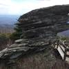
Rocky ridgeline corner on the Sinkhole descent.
Nov 19, 2018 near Glen Al…, NC
Leaping the Sinkhole is not recommended...
Dec 17, 2016 near Glen Al…, NC
This is why the 4099 is one of the more scenic roads in all Pisgah!
Dec 17, 2016 near Linville, NC

0 Comments

Weather


Current Trail Conditions

Unknown
Add Your Check-In

Check-Ins

Oct 8, 2023
Chris Coffee
Don't trust the maps on AllTrails or Hiking Project for correct location of the Holly Springs Trail; The S.C. loop is pretty easy. Views are sparse 9mi — 3h 40m
Apr 2, 2022
Hal Queen
Feb 4, 2020
Chad Randolph
Hiked it in reverse, so the singletrack was all in the beginning. That sinkhole is no joke. 7.4mi — 2h 53m
Sep 2, 2018
John Serrano
Nov 18, 2017
Sarah Genay
Maybe it’s just me, but I couldn’t find Holly Springs Trail #273 and had to turn around. 15mi
Welcome

Join the Community

Create your FREE account today!
Already have an account? Login to close this notice.

Get Started