
 Continue with onX Maps
 Continue with Facebook


 Particularly Special Place


 Easy/Intermediate
Easy/Intermediate
Easy/Intermediate
 Easy/Intermediate
 Topanga State Park to Parker Mesa Overlook
3.4 mi 5.4 km • 588' Up 179.18 m Up • 248' Down 75.48 m Down
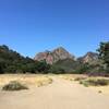
 Red Rock Canyon
3.7 mi 5.9 km • 697' Up 212.38 m Up • 697' Down 212.34 m Down
 Hondo Canyon
4.1 mi 6.6 km • 121' Up 36.9 m Up • 1,703' Down 519.07 m Down
Upper Las Virgenes to Victory Loop
6.7 mi 10.7 km • 932' Up 284.07 m Up • 929' Down 283.04 m Down
King Gillete Ranch Loop
1.8 mi 2.9 km • 240' Up 73.2 m Up • 240' Down 73.2 m Down
 M.A.S.H Out-and-Back
4.8 mi 7.7 km • 226' Up 68.94 m Up • 226' Down 68.98 m Down
Agoura, CA


0 Comments