Hiking Project Logo

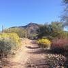
The most popular trail in the park provides beautiful views and a good climbing workout.


Your Rating: Rating Rating Rating Rating Rating      Clear Rating
Your Difficulty:
Your Favorites: Add To-Do · Your List
Zoom in to see details
Map Key

1.5

Miles

2.4

KM

Point to Point

2,772' 845 m

High

2,032' 619 m

Low

740' 226 m

Up

0' 0 m

Down

10%

Avg Grade (5°)

33%

Max Grade (18°)

Dogs Leashed

Features Cave · Views

As with the other trails in this park, this one is closed after dark. It can be treacherous, so obey the rule.

Description

In my experience, this is the most popular trail in the park. The upper half of the trail is steeper and a bit more difficult than the lower half: you switch pretty quickly from gradual climbing to what feels a lot like many flights of stairs before cutting across the face of the mountain and then climbing more "stairs" up to the cave.

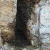
The "cave" at the end of this trail is not so much a dark, cavernous hole full of bats or anything that dramatic. This cave is about 10 to 12 feet high and is more like a gash carved out of the side of the mountain. It provides welcome shade in the summer, and a place to catch your breath before beginning the descent. The scenery is excellent on clear days, and you can even see the Fountain Hills fountain shooting water into the sky if you're up there at the right time.

Take a minute to get a drink and snack, enjoy the view, then make sure your shoes are laced tight before starting back down. Remember the uphill hiker has the right of way.

Flora & Fauna

Typical Sonoran desert cacti, lizards, the occasional snake, horned toad or desert tortoise. In early mornings, look for deer and listen for coyote in the evening. Ocotillo, saguaro, prickly pear, and a few trees.

Contacts

Shared By:

Doug Baer

Trail Ratings

  4.0 from 21 votes

#897

Overall
  4.0 from 21 votes
5 Star
24%
4 Star
57%
3 Star
19%
2 Star
0%
1 Star
0%
Trail Rankings

#46

in Arizona

#897

Overall
141 Views Last Month
6,956 Since Nov 28, 2016
Intermediate/Difficult Intermediate/Difficult

0%
0%
70%
5%
25%
0%

Photos

Enjoy this view from the cave at the trail's end. The Fountain Hills are located in the distance to the right.
Mar 7, 2017 near Apache…, AZ
Wind Cave Trail, Usery Mountain Regional Park, Phoenix.
Jun 8, 2018 near Apache…, AZ

0 Comments

Weather


Current Trail Conditions

Unknown
Add Your Check-In

Check-Ins

Join the Community

Create your FREE account today!
Already have an account? Login to close this notice.

Get Started.