
 Continue with onX Maps
 Sign in with Facebook


 Particularly Special Place


 Intermediate/Difficult

 Intermediate/Difficult
Land Manager: USFS - Tonto National Forest Office
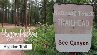
 See Canyon Horton Springs Loop
14.4 mi 23.2 km • 2,962' Up 902.8 m Up • 2,962' Down 902.74 m Down
 Star Va…, AZ
Cabin Loop Trail
Star Va…, AZ
Cabin Loop Trail
18.2 mi 29.2 km • 2,395' Up 729.94 m Up • 2,401' Down 731.69 m Down
Star Va…, AZ
Mazatzal Peak Loop
15.1 mi 24.4 km • 2,868' Up 874.13 m Up • 2,841' Down 865.98 m Down


 All Clear


0 Comments