
 Continue with onX Maps
 Continue with Facebook


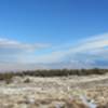
 Particularly Special Place


 Intermediate


 Intermediate
Land Manager: BLM Colorado - Grand Junction Field Office
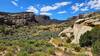
 Monument Canyon and Wedding Canyon
7.2 mi 11.5 km • 961' Up 292.84 m Up • 960' Down 292.75 m Down
Fruita, CO
 Black Ridge Trail
11.4 mi 18.3 km • 1,204' Up 366.84 m Up • 1,203' Down 366.81 m Down
Rabbit's Ear
6.1 mi 9.8 km • 792' Up 241.34 m Up • 792' Down 241.47 m Down
Loma, CO
Devils Kitchen
1.1 mi 1.8 km • 242' Up 73.74 m Up • 242' Down 73.82 m Down
Redlands, CO
Eagle's Nest Loop
6.2 mi 9.9 km • 1,168' Up 355.87 m Up • 1,170' Down 356.6 m Down
Fruita Trail Half
12.0 mi 19.3 km • 1,111' Up 338.6 m Up • 1,118' Down 340.7 m Down
Fruita, CO


0 Comments