Hiking Project Logo

An open, airy trail offering stunning views from the tallest point in Pinnacles National Park.


Your Rating: Rating Rating Rating Rating Rating      Clear Rating
Your Difficulty:
Your Favorites: Add To-Do · Your List
Zoom in to see details
Map Key

3.3

Miles

5.3

KM

Point to Point

3,305' 1,007 m

High

1,611' 491 m

Low

1,695' 516 m

Up

0' 0 m

Down

10%

Avg Grade (6°)

25%

Max Grade (14°)

Dogs No Dogs

Features Views · Wildflowers

Check for raptor closures before attempting any off-trail hiking or climbing.

Bring lots of water! None is available along the trail.

Description

From Bear Gulch Reservoir, the trail is located on the south side of the dam. The trail follows the contours of the reservoir for a short distance before turning south towards Pinnacles highest points. The trail maintains a steady ascent passed such rock formations as The Sisters, The Love Handles, Kasparek's, Ridge Rock, The Hatchet, Gertie's Pinnacle, The Goal Posts, The Driver, Cortadura Wall, and The Yaks. Eventually, near the end of the hike, the trail joins a dirt road before terminating at an old fire lookout tower on North Chalone Peak, the highest point in Pinnacles National Park. The trail is well-maintained and easy to follow. Once you've had your fill, head back the way you came!

To extend this hike and before heading back, consider taking the unmaintained South Chalone Peak Trail and the second highest point in the park.

Flora & Fauna

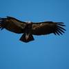
Pinnacles is currently one of five release sites for California Condors. The park hosts more than thirty of these scavengers. These birds are best seen in the higher regions of the park and can also often be seen on a hill behind the campsites. Pinnacles is also home to many species of raptors and other birds and is an excellent area for birding.

Wildflowers like Larkspur, California buckeye, Elegant clarkia, California buckwheat, Mariposa lily, Bush poppy, Gray mule-ears, Indian Warrior, California poppy and many others are abundant in spring.

Look for manzanita shrubs interspersed among patches of chaparral.

The park is also home to around 300 different species of lichens, which are easily visible on the many rock formations they color.

Contacts

Shared By:

Quin TCM

Trail Ratings

  4.3 from 9 votes

#7958

Overall
  4.3 from 9 votes
5 Star
33%
4 Star
67%
3 Star
0%
2 Star
0%
1 Star
0%
Trail Rankings

#671

in California

#7,958

Overall
8 Views Last Month
2,039 Since Apr 8, 2015
Intermediate Intermediate

0%
14%
71%
0%
14%
0%

Photos

Monolith Rock
May 14, 2023 near Soledad, CA
Bear Gulch Reservoir
May 14, 2023 near Soledad, CA
Pinnacles natural waters
Aug 10, 2016 near Soledad, CA
Bear Gulch Reservoir
May 14, 2023 near Soledad, CA
The trail leading up to North Chalone Peak. You'll notice the fire tower at the top.
Feb 20, 2016 near Soledad, CA
Pinnacles above Bear Gulch Reservoir
Oct 14, 2017 near Soledad, CA

0 Comments

Weather


Current Trail Conditions

Unknown
Add Your Check-In

Check-Ins

Apr 8, 2023
Marc Daniel
With Mila till 1.88 logout point — 15h 00m
Apr 2, 2022
Nicolas Lidzborski
6.6mi — 16h 00m
Feb 26, 2022
Jeremiah Johnson
3.3mi
Jan 10, 2021
David Hitchcock
Jan 6, 2021
Tom Herr
Steady, gradual out-and-back through the chaparral. Rock formations and vistas along the way. Lower Caves before start of trail was highlight. 6.6mi
Jun 22, 2019
Bailey Ramler
Jan 31, 2019
Allen York
Dec 23, 2018
Lisa Incata
The gate towards the top was closed - because of government shutdown? hard uphill
Welcome

Join the Community

Create your FREE account today!
Already have an account? Login to close this notice.

Get Started