
 Continue with onX Maps
 Continue with Facebook


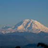
 Particularly Special Place


 Intermediate


 Intermediate
Land Manager: King County, WA - Parks and Recreation
 Bridle Trails State Park - Outer Loop
4.4 mi 7.1 km • 231' Up 70.32 m Up • 205' Down 62.49 m Down
 Discovery Park and Lighthouse Loop
4.0 mi 6.5 km • 406' Up 123.68 m Up • 405' Down 123.39 m Down
Seattle, WA
Cross Island Trail
4.9 mi 7.8 km • 469' Up 142.87 m Up • 430' Down 130.93 m Down
Bainbri…, WA
Poo Poo Point via East Sunset Way Trailhead
7.7 mi 12.4 km • 2,110' Up 643.16 m Up • 2,109' Down 642.96 m Down
 Poo Poo Point via Chirico Trail
3.9 mi 6.3 km • 1,619' Up 493.34 m Up • 1,618' Down 493.27 m Down
Issaquah, WA
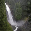
Wallace Falls and Lake
11.1 mi 17.9 km • 2,419' Up 737.35 m Up • 2,419' Down 737.32 m Down


0 Comments