
 Continue with onX Maps
 Continue with Facebook


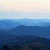
 Particularly Special Place


 Easy/Intermediate
Easy/Intermediate
Easy/Intermediate
 Easy/Intermediate
Local Club: New England Mountain Bike Association (NEMBA)
Land Manager: USFS - Saco Ranger Station
 Mt. Chocorua - Champney Falls Route
7.2 mi 11.5 km • 2,162' Up 659.05 m Up • 2,163' Down 659.27 m Down

 Ferncroft, NH
 Arethusa Falls Out and Back
2.9 mi 4.7 km • 868' Up 264.68 m Up • 869' Down 264.78 m Down
 Pemi Loop
30.0 mi 48.2 km • 7,408' Up 2257.85 m Up • 7,402' Down 2256.07 m Down
Lincoln, NH
Ledge to Pine Mountain Loop
3.5 mi 5.7 km • 810' Up 246.98 m Up • 808' Down 246.22 m Down
Gorham, NH
The Presidential Traverse
19.0 mi 30.5 km • 7,705' Up 2348.41 m Up • 7,131' Down 2173.59 m Down
Gorham, NH
Rattlesnake
1.8 mi 2.8 km • 344' Up 104.84 m Up • 346' Down 105.33 m Down
Holderness, NH


0 Comments