Dogs Leashed

Features
Birding · Cave · Commonly Backpacked · Views · Wildflowers · Wildlife


The ponies are wild and should not be fed, for both the hikers safety and that of the ponies.

Overview

This out and back hike is one of the best in the Eastern United States and one of the premier hikes in Virginia, which is saying a lot for the home of Shenandoah National Park.
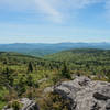
The hiker starts with a scenic drive up through Route 362 and into Grayson Highlands State Park. You are then subjected to incredible, open field beauty with constant views of the surrounding Blue Ridge Mountains. As you progress to the 5,700 ft summit, the views increase in intensity and beauty, topped of by the area surrounding Rhododendron Gap which is a fitting culmination point for several high knobs the route traverses through.
The summit itself is like few others, featuring a dense hemlock grove that looks more like the state of Washington than the state of Virginia.
Along almost the entire route there are chances for encounters with wild ponies and free range cattle. In all, about 150 ponies roam this countryside.
Need to Know

$5 entry fee into Grayson Highlands State Park, $7 for non Virginians. Weather can be unpredictable and Mt Rogers is often referred to as the Mt Washington of the Southeast. Be prepared for wild temperature swings and precipitation at a moments notice. GPS coordinates are useful to reach the parking area: 36.633297, -81.508685.
There is water at the Thomas Knob shelter.
Description

The hike begins at the Massie Gap parking lot with the trailhead immediately north of the lot through a field. Since there are ponies throughout much of the hike, you'll pass through several gates (be sure to close them) and the first one across this first field and marks the beginning of
Rhododendron Trail (Massey Gap - AT Connector). This short 0.8-mile trail can be beautiful when the trail's namesake is in bloom.
The only confusing section of the trail is at the point where
Rhododendron Trail (Massey Gap - AT Connector) intersects with the
AT: Mt. Rogers Appalachian Trail Club (VA) and the Virginia Highlands Connector Trail. Maps show all 3 trails connecting at the same location (and the free park map doesn't even display the VHC), and they may, but while on the trail it did seem to us we traversed the VHC for a few hundred yards before hopping on the AT. There are many sign posts, but they are not always intuitive. A GPS and the
Hiking Project mobile app is extremely useful. The important thing is to find your way to the AT heading southbound. The area is very open and easy to spot all the trails, so just be sure you are on the right one.
Continue on the AT and about 0.9 miles later, bear left onto the
Wilburn Ridge Trail. This short trail contains a very fun rock scramble the offers some of the best views on the hike. (You can simply skip this section and continue on the AT if scrambling isn't to your liking). It is strongly recommended to at least attempt this trail; it is well worth your time and sweat.
Rhodendron Gap follows about 1 mile after the
Wilburn Ridge Trail rejoins the AT. Here you can climb Pinnacle Rock for expansive 360-degree views of the entire area. This is a must-see and a great place for a break. Hold on to your hat though; with no trees to block the breeze it can be very windy.
Rested, continue on the AT for another 1.5 miles, passing the Thomas Knob Shelter (fairly new and large), entering the Lewis Fork Wilderness, and picking up the
Mount Rogers Summit Trail, bearing right. Despite the myriad of views along the way, the highlight of this hike may be the summit itself. There is absolutely no view from the top, but the serenity of this dense grove (hemlock and others) cannot be understated. It looks eerily similar to pictures of the Pacific Northwest with moss growing on almost every wooded surface, lush ferns, and damp trails with exposed root structures. Magnificent.
Retrace your steps from this point, bypassing
Wilburn Ridge Trail and sticking with the
AT: Mt. Rogers Appalachian Trail Club (VA) . Unlike most other out-and-back hikes, this open expanse offers a different feeling on the way down than it did on the way up.
Flora & Fauna

A wide variety as you climb to the summit - rhododendron, open grassland, and spruce - fir forest. There are wild ponies and free range cattle as well. Many hawks too.
History & Background

Trail passes through Grayson Highlands State Park, the Mt Rogers Recreational Area, and the Lewis Fork Wilderness.
The summit has been changing over the past decades. With the woody adelgid insect destroying hemlock groves up and down the east coast, Mt Rogers has been hit particularly hard. Local hikers have noticed distinct changes in the forest canopy, with the thinning of the tree needles resulting in a drier forest floor and a changing ecology.
Contacts
Shared By:
Lou Poulas

 Grayson Highlands: A.T. – Pine Mtn Loop


 Marion, VA
 Mt. Rogers Out-and-Back


 Marion, VA
 Virginia Creeper National Recreation Trail


 Jefferson, NC
 Alligator Rocks to Bluff Mountain


 Sparta, NC
 Doughton Recreation Area Loop


 Hays, NC
 Brumley Mountain Trail - Hayter's Gap to the Great Channels


 Lebanon, VA


0 Comments