Dogs Leashed

Features
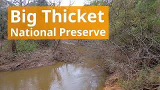
River/Creek · Wildlife
Family Friendly
The Kirby Nature Trail is interpretive so the whole family can learn about the diverse wildlife in Texas.
Overview
Big Thicket National Preserve is a little visited part of the national park system in eastern Texas that has a wide variety of biology and well-maintained trails. This route will take you through swamps, dry pine forests, and dense thickets. Most of the route is well-shaded which is an added bonus in the Texas summer.
Need to Know
Big Thicket is an area designed by nature to flood, so keep an eye on recent weather and trail closures. However, most low areas and all creek have bridges over them. Park entrance is free.
Description
The parking area for this trail is pretty easy to find compared to other trail heads in Big Thicket National Preserve. The parking area is for the Kirby Nature Trail just off FM 420, just 2.5 miles past the Big Thicket Visitor Center (which is also easier to find in a GPS). There is a decent amount of parking available along with bathrooms and a drinking fountain.
You can start this path by following the
Kirby Nature Trail Inner Loop to the east. The trail begins as a mix of either paved or boardwalk, but this doesn't last long. At the first intersection, keep to the left. This guide will follow the trail clockwise, which stays paved longer than counterclockwise. Even though the paved section ends, the entire trail is always about four feet wide and could (theoretically) be accessible. But deep sand/gravel/roots could make it very tough going for a wheelchair.
Continue north along the wide trail. The west side of Kirby Nature Trail has a number of swamps that are crossed by boardwalks and offer views of the interesting plant life. There are more mosquitoes on the west side of the loop as a result. At about 2/3 of a mile, you'll reach the
High Water Bypass which is also a shortcut. Continue on the Kirby Trail to see more of the swamps.
At one mile you'll see a picnic area with two wheelchair-friendly tables to the north of the nature trail. Head towards them, and you'll clearly see a bridge over Village Creek. Follow the trail over the bridge for about 0.8 miles of unremarkable trail. Soon you'll reach a bridge over Turkey Creek. Head over to the base of
Sandhill Loop. Continuing clockwise will allow you to continue along the creek (although actual views of the creek are limited) before reaching the intersection with the Turnkey Creek Trail. Head east along
Sandhill Loop. Once into the tall lodge pole pines the trail becomes noticeably more open and dryer. As a result the 2/3 of
Sandhill Loop away from Turkey Creek has significantly fewer mosquitoes.
Eventually, the tall pine forest will turn back into the thick (thicket) forest, and you'll come back to Turkey Creek. Return over the bridge and along the 0.8 mile trail to the small picnic area just south of Village Creek. Immediately after crossing the bridge, look for where the
Kirby Nature Trail Outer Loop heads east. If you don't want to do the Outer Loop, you can continue back to the Kirby Nature Trail (called Inner Loop here) and take it back to the parking area. Otherwise the Outer Loop will take you on a more secluded route to the east. There is nothing fantastically interesting on the Outer Loop, but it will add about a mile onto your outing, and you are unlikely to see anyone - which means you might see some more interesting wildlife.
The Outer Loop will join back up with the Kirby Nature Trail (aka Inner Loop on signs) which you can follow back to the parking area.
Flora & Fauna
Mosquitoes and ticks abound, so wear bug spray. Wildlife is very diverse, so keep an eye out for snakes, birds, wild boar and more.
Contacts
Shared By:
Karl W


 Continue with onX Maps
 Sign in with Facebook


 Particularly Special Place


0 Comments