Hiking Project Logo

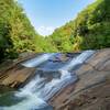
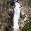
A challenging journey ending at a beautiful campsite next to a waterfall.


Your Rating: Rating Rating Rating Rating Rating      Clear Rating
Your Difficulty:
Your Favorites: Add To-Do · Your List
Zoom in to see details
Map Key

6.7

Miles

10.8

KM

Out and Back

1,483' 452 m

High

1,095' 334 m

Low

396' 121 m

Up

396' 121 m

Down

2%

Avg Grade (1°)

9%

Max Grade (5°)

Dogs Leashed

Features Birding · Fall Colors · River/Creek · Spring · Swimming · Views · Waterfall · Wildlife

There is a parking fee. Standard GA Parks rates apply ($5 per vehicle). Roadside parking is free.

Overview

This trail is a fun but challenging one. Wear good shoes and be ready for a journey. This trail has it all: muddy paths, rocks with slight bouldering required, steep ledges leading to great riverside views, great campsite locations, and fantastic waterfalls.

Need to Know

Dress for the occasion; bring layers in the cold as you'll get hot at times, water, first aid kit for scrapes and falls, and, if in the summer months, bring a bathing suit to take a dip in the pool at the end!

Description

Parking:
This is a bit difficult as there is very little parking. About 4-5 cars can park beside the trailhead, and another 10-12 can park across the street, so be sure to get here early to have a spot. The park charges $5 per vehicle or the State Annual Parks pass will work ($50 purchased online).

Trailhead and Signage:
The trailhead is well-marked and easy to find. It starts next to a stream which leads under the interstate. The underside of the bridge is covered in ever-changing graffiti, however, this only seems to take enhance the unique view. Signage from start to finish is adequate with some white blazes on trees; however, in two cases a blazed tree was down on the trail which could cause some confusion.

The Trail:
The journey is the best part right? The trail, at 3.2 miles one-way, is a healthy length and has its fair share of river views, foliage, trees to climb over, boulders to scramble around, and rocks to trip over. For most of the trail, you'll be heading south-southeast on the outbound leg towards the falls. Along the way, there are a decent number of places to set up a hammock and rest, logs to sit on, and at least four good places for a full campsite with room for about four double occupancy tents.

You parallel the banks of the river the entire length of the trail and are seldom out of the view of the river. There are a few river crossings, but all have wonderfully built bridges with handrails and firm footing. There are a few steep ledges along the path which can feel a bit treacherous without trekking poles, but the presence of steel cable railings make them safe to cross. Multiple waterfalls on this trail keep you pushing past the difficult terrain so you can see what lies ahead. The final waterfall is a fabulous place to sit, rest and just enjoy nature; there is also a nice swimming hole nearby. The hike back can feel more challenging since the path is uphill.

Overall:
This is not a "let me take a quick stroll in the woods with my significant other" type of trail; this is the "my significant other and I like to be challenged and want a fun adventure" type trail. It is a fun hike with a group also as the extra hands will make it easier to get over some of the "harder" parts.

Contacts

Shared By:

JC Miller with improvements by Rob Seymour

Trail Ratings

  4.5 from 35 votes

#360

Overall
  4.5 from 35 votes
5 Star
60%
4 Star
29%
3 Star
11%
2 Star
0%
1 Star
0%
Recommended Route Rankings

#4

in Georgia

#360

Overall
7 Views Last Month
4,236 Since Nov 3, 2016
Difficult Difficult

0%
0%
16%
14%
68%
3%

Photos

Well worth the trip!
Aug 23, 2020 near Toccoa, GA
The end result.
Jan 10, 2018 near Toccoa, GA
Panther Creek Falls cascades serenely through Chattahoochee National Forest.
Feb 2, 2017 near Toccoa, GA
Stay to the right
Jan 10, 2018 near Toccoa, GA

0 Comments

Weather


Current Trail Conditions

Minor Issues 68 days ago
Add Your Check-In

Check-Ins

Jun 30, 2024
Andrew Larey
8.5mi — 3h 00m
May 25, 2023
Z Mags
Great/ beautiful hike! Early was best choice, less people! 6.7mi — 8h 00m
Jun 3, 2022
Randy E
Feb 11, 2022
Doug Tam
May 1, 2021
Andrew Larey
8mi — 4h 00m
Sep 25, 2020
Nate Ritter
Great waterfall at the end. Big campsite at bottom of waterfall. Moderate hike. 7.4mi — 2h 46m
May 31, 2020
Paul Skvarek
Parked road-side — 9h 32m
Welcome

Join the Community! It's FREE

Already have an account? Login to close this notice.