Hiking Project Logo

One of the most isolated and varied trail at Sweetwater Creek State Park.


Your Rating: Rating Rating Rating Rating Rating      Clear Rating
Your Difficulty:
Your Favorites: Add To-Do · Your List
Zoom in to see details
Map Key

4.8

Miles

7.8

KM

Point to Point

1,023' 312 m

High

780' 238 m

Low

387' 118 m

Up

392' 119 m

Down

3%

Avg Grade (2°)

17%

Max Grade (10°)

Dogs Leashed

Features Fall Colors · River/Creek · Spring · Wildflowers

Description

The White Trail begins at the front door of the visitor center. Turn right at the main trailhead to stay on the White Trail (the Red Trail descends to the left). After you enter the forest, the trail will fork. You can go either way, but going right allows you to get a good warm up with gentle inclines. It also allows you to get some of the less-scenic parts out of the way.

After turning right, you'll cross a couple of park roads and eventually end up on an old gravel road. At about a mile, you'll turn left on another gravel road. Follow that all the way to some large fields (great for seeing wildlife in the morning and evening). The White Trail turns right in the fields, continuing southwest. You'll soon be on a rock doubletrack descent which will take you to a narrower trail nestled in a stream drainage. Keep following the white blazes.

After about 2.3 miles, keep going straight at the intersection with the Brown Trail (where there is a bridge to the right), and you'll eventually end up at Sweetwater Creek. Along the creek, the trail goes through a lot of little rock gardens and there are some easy scrambles over large rock outcroppings. You'll do this for a while until you hit some very steep stairs. Climb the stairs and follow the boardwalk over some steep sections.

Eventually you'll come to a confusing intersection with the Red Trail. The White Trail goes up the steep, eroded stairs, while the Red Trail goes back towards the river. Turn left and climb up a switchback until the trail levels out on the side of a hill. You'll meander around the hills and then come out at the New Manchester ruins. Stop and take a photo, then continue left away from the ruins up the White Trail. Stay right at the intersection with Green Trail. Continue on through two large, lush stream drainages and back to the visitor center.

Note: The trail is VERY eroded in parts and has a lot of rocks, roots, and short steep climbs. This is not a hike for the faint of heart!

Flora & Fauna

Ferns, fields, beech, deer, copperhead snakes.

Contacts

Shared By:

Daniel Jessee

Trail Ratings

  4.1 from 11 votes

#8626

Overall
  4.1 from 11 votes
5 Star
36%
4 Star
36%
3 Star
27%
2 Star
0%
1 Star
0%
Trail Rankings

#144

in Georgia

#8,626

Overall
2 Views Last Month
948 Since Jul 30, 2016
Intermediate Intermediate

0%
0%
80%
0%
20%
0%

Photos

Playing in Spring Creek
Jun 11, 2018 near Austell, GA
Red Trail follows Sweetwater Creek in its namesake state park.
Feb 26, 2017 near Austell, GA
Ruined mill.
Aug 13, 2016 near Austell, GA
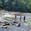
Rocky Sweetwater Creek.
Jul 30, 2016 near Austell, GA
Mill ruins.
Aug 9, 2016 near Austell, GA
The old ruined mill of Sweetwater Creek State Park. Located halfway through the Red Trail.
Jul 31, 2016 near Austell, GA

0 Comments

Weather


Current Trail Conditions

All Clear 42 days ago
Add Your Check-In

Check-Ins

Jun 18, 2023
Mikayla John
Pretty easy and scenic
Jun 30, 2021
Alexander Barinov
5mi — 1h 39m
Apr 25, 2021
Eugene Liu
Apr 2, 2021
Thomas Buzzek
Mar 21, 2021
sc1080
5mi — 1h 45m
Dec 5, 2020
Marcus Kubota
Mar 15, 2020
Magdiel Marquez
Sep 15, 2019
James Nelson
Welcome

Join the Community

Create your FREE account today!
Already have an account? Login to close this notice.

Get Started