
 Continue with onX Maps
 Sign in with Facebook


 Particularly Special Place


 Difficult
Difficult
Difficult
 Difficult
Land Manager: NPS - Glacier National Park
 Pitamakan/Dawson Loop
18.0 mi 29.0 km • 3,297' Up 1004.97 m Up • 3,298' Down 1005.18 m Down
 Bison, MT
 Firebrand Pass
10.5 mi 16.8 km • 1,956' Up 596.08 m Up • 1,955' Down 596.02 m Down
 Montana Trail Section 3
122.9 mi 197.9 km • 18,227' Up 5555.68 m Up • 18,210' Down 5550.35 m Down
 Hidden Lake Overlook
2.7 mi 4.3 km • 490' Up 149.25 m Up • 489' Down 149 m Down
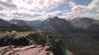
Red Roc…, MT
Grinnell Glacier
10.3 mi 16.6 km • 1,774' Up 540.61 m Up • 1,777' Down 541.59 m Down
Swiftcu…, MT
Many Glacier Loop
62.2 mi 100.2 km • 11,321' Up 3450.67 m Up • 11,322' Down 3450.83 m Down
Swiftcu…, MT


 All Clear


0 Comments