
 Continue with onX Maps
 Sign in with Facebook


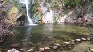
 Particularly Special Place


 Intermediate
Intermediate
Intermediate
 Intermediate
Land Manager: USFS - Angeles National Forest Office
 Chantry Flat/Mt. Wilson Loop
15.3 mi 24.6 km • 4,195' Up 1278.55 m Up • 4,183' Down 1274.84 m Down

 Sierra…, CA
Mt. Wilson - West Fork Loop
Sierra…, CA
Mt. Wilson - West Fork Loop
10.6 mi 17.0 km • 2,908' Up 886.29 m Up • 2,908' Down 886.23 m Down
 Mt. Lowe Railway Ruins
5.3 mi 8.5 km • 1,344' Up 409.63 m Up • 1,344' Down 409.51 m Down
Altadena, CA
 Eaton Saddle to Switzer via Bear Canyon
8.1 mi 13.1 km • 880' Up 268.16 m Up • 2,729' Down 831.83 m Down
Altadena, CA
Sunset Ridge to Dawn Mine Loop
5.9 mi 9.5 km • 1,527' Up 465.45 m Up • 1,527' Down 465.31 m Down
Altadena, CA
El Prieto to Brown Mountain Loop
8.2 mi 13.2 km • 1,254' Up 382.3 m Up • 1,254' Down 382.32 m Down


0 Comments