Dogs No Dogs
Features
River/Creek · Views · Waterfall
Closed only if you can't get to the North Rim in the snow. Otherwise, the trail is yours all year round, although you may need snowshoes in the winter or early spring.
Need to Know
Great views exist along the North Rim. Most of the hiking along the North Rim necessitates backpacking for at least one night, so make sure you have enough supplies. Some of the creeks along the North Rim dry up in the summer, so make sure you have enough water for your hike.
Description
The trail starts at the top of
Yosemite Falls and makes it way to
North Dome with views of
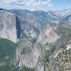
Yosemite Falls, Yosemite Valley, and major peaks like
Clouds Rest,
Half Dome,
Sentinel Dome, and
Glacier Point.
You have a couple of options to get to the starting point. You can hike up from the Valley via the
Upper Yosemite Falls Trail or hike in from Tioga Road via the
Yosemite Creek Trail. Another alternative is to hike in from Big Oak Flat Road on the North Rim trail, a trail that takes you to the top of
El Capitan and Eagle Peak before reaching
Yosemite Falls.
Your trail begins at the top of
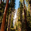
Yosemite Falls, so make sure you take in Yosemite Creek as it plunges over the edge of the North Rim. If it's spring, the roar of the water as it plunges over the edge is breathtaking. Once you've taken in the view from the precipice, cross the footbridge over
Yosemite Falls Creek. This is a good place to fill your water bottles, but make sure you don't slip and fall in as it's a short trip to a long drop. Follow a series of switchbacks until you reach the metal railing at Yosemite Point. Off to your right, you'll see
Lost Arrow, where you may catch climbers slack-lining from the rim to the top of the rock. Directly below you is Yosemite Village and off to your left is
Half Dome,
Glacier Point, and
Clouds Rest.
You start up a crest and encounter boulders that are worth climbing around on. The trail descends into a forest of white furs and Jeffrey pines before it bottoms out in a red-fir gully. Indian Canyon Creek provides a chance to get water before you start climbing out of the canyon. Other creeks on the rim routinely dry up, especially in late July and August.
Once you pass Indian Canyon Creek, the trail begins climbing until you encounter the
Lehamite Creek Trail, a trail that leads to Tioga Road. The trail continues straight ahead as it climbs, steeply at times, over a ridge and then descends to Royal Arch Creek, another seasonal creek. A series of switchbacks carries the trail to the top of Indian Ridge. At this point,
Half Dome looms large in front of you and
North Dome is down the hill from this junction with
Porcupine Creek - North Dome Trail.
You should make the side trip to the top of
North Dome to take in the views. Your other choices require you going to the left and follow the
Porcupine Creek - North Dome Trail. You can follow this all the way back to Tioga Road, or you can follow the trail until the Snow Creek breaks off to the right.
Flora & Fauna
Jeffrey pine, red-fir, and white fir trees are found throughout the trail.
Deer, bear, ground squirrels, and mountain quail have been seen in the area.
Contacts
Shared By:
David Hitchcock
1 Comment