Continue with onX Maps
 Sign in with Facebook


 Particularly Special Place


Fairfield County
 CT
CT- Fairfield County


Recommended Routes in Fairfield County - 6
Hiking Project is built by hikers like you. Add Your Recommended Routes


 Easy/Intermediate
Yellow Loop/Nature Trail
3.7 mi 5.9 km • 226' Up 68.86 m Up • 233' Down 71.04 m Down
 Riverside, CT

 Intermediate/Difficult
Zoar Trail
6.4 mi 10.2 km • 1,105' Up 336.9 m Up • 1,105' Down 336.9 m Down
 Intermediate/Difficult
Pine Mountain
4.1 mi 6.6 km • 677' Up 206.32 m Up • 677' Down 206.2 m Down

 Intermediate
Devils Den Nature Preserve Perimeter
8.1 mi 13.1 km • 610' Up 185.91 m Up • 618' Down 188.22 m Down

Fairfield County Hiking
- 240 Miles 386 Kilometers of Trail
- 6 Recommended Routes
- 78
Easy Trails

- 183
Intermediate Trails

- 34
Difficult Trails

Areas Within Fairfield County
Weather Averages
|
High
|
Low
|
Precip
|
Days w/
|
| J | F | M | A | M | J | J | A | S | O | N | D |
Trails in Fairfield County - 289
Hiking Project is built by hikers like you. Add Your Trails
2.0
mi
3.2
km
#1Norwalk River Valley Trail
 Easy
Easy
Wilton, CT
|
Easy
|
Wilton, CT |
6
|
|
|
10.7
mi
17.3
km
#2Saugatuck Trail
Intermediate/Difficult
Easton, CT

|
Intermediate/Difficult
|
Easton, CT |
10
|
|
|
4.4
mi
7.1
km
#3Shelton Lakes Recreation Path
Easy
Shelton, CT
|
Easy
|
Shelton, CT |
2
|
|
|
0.8
mi
1.3
km
#4Norwalk River Valley Trail: Redding Mile
Easy
Ridgefield, CT
|
Easy
|
Ridgefield, CT |
2
|
|
|
0.5
mi
0.9
km
#5Winslow Dog Park Outer Loop
Easy
Westport, CT
|
Easy
|
Westport, CT |
1
|
|
|
0.4
mi
0.7
km
#6Sidecut Trail
Intermediate
Bethel, CT
|
Intermediate
|
Bethel, CT |
1
|
|
|
0.1
mi
0.2
km
#7Sugarbush Trail
Intermediate
Redding, CT
|
Intermediate
|
Redding, CT |
1
|
|
|
1.6
mi
2.6
km
#8Perimeter Trail
Intermediate
Redding, CT
|
Intermediate
|
Redding, CT |
1
|
|
|
0.1
mi
0.2
km
#9Encampment Trail
Easy
Redding, CT
|
Easy
|
Redding, CT |
1
|
|
2.6
mi
4.2
km
#10Red Trail
 Difficult
Easton, CT
|
Difficult
|
Easton, CT |
4
|
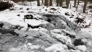
Photos of Fairfield County - 118
Hiking Project is built by hikers like you. Add Your Photos