
 Continue with onX Maps
 Continue with Facebook


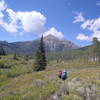
 Particularly Special Place


 Intermediate

 Intermediate
 Bowmans Shortcut
8.5 mi 13.8 km • 1,718' Up 523.53 m Up • 1,717' Down 523.35 m Down
 Frisco, CO
 Upper Piney River Trail
6.1 mi 9.8 km • 845' Up 257.64 m Up • 846' Down 257.79 m Down
Vail, CO
Cross Creek Out-and-Back
5.1 mi 8.1 km • 723' Up 220.42 m Up • 723' Down 220.4 m Down
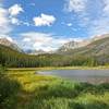
Upper Slate Lake
22.7 mi 36.5 km • 4,091' Up 1247.06 m Up • 4,091' Down 1246.96 m Down
Silvert…, CO
Rock Creek to Lower Boulder Lake
5.7 mi 9.2 km • 1,060' Up 323.17 m Up • 1,060' Down 323.07 m Down
 Rock Creek Loop
12.1 mi 19.5 km • 3,123' Up 951.92 m Up • 3,123' Down 951.92 m Down


0 Comments