Hiking Project Logo

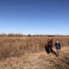
A multi-use path with a some elevation if you're heading from the river area to the Northeast.


Your Rating: Rating Rating Rating Rating Rating      Clear Rating
Your Difficulty:
Your Favorites: Add To-Do · Your List
Zoom in to see details
Map Key

7.1

Miles

11.5

KM

Point to Point

1,352' 412 m

High

1,271' 387 m

Low

166' 51 m

Up

85' 26 m

Down

1%

Avg Grade (0°)

7%

Max Grade (4°)

Dogs Leashed

Description

This path connects Chapin, Plainview, Cessna, and Cottonwood Parks. This path is all paved from I-35 from Towne East to Chapin Park Path while passing by Spirit Aerospace.

This path crosses highway K-15 at McArthur. Use the crosswalk, and you'll be fine. Occasionally you might see a train taking airplane fuselages out of the facility.

Learn about gypsum, a mineral commonly found in Kansas and exposed along this creek bed by following this link: kgs.ku.edu/Extension/lowlan…

Contacts

Shared By:

Andy Cramb

Trail Ratings

  4.0 from 1 vote

#4

in Wichita

#18478

Overall
  4.0 from 1 vote
5 Star
0%
4 Star
100%
3 Star
0%
2 Star
0%
1 Star
0%
Trail Rankings

#4

in Wichita

#93

in Kansas

#18,478

Overall
2 Views Last Month
101 Since Nov 27, 2019
Easy Easy

100%
0%
0%
0%
0%
0%

0 Comments

Weather


Current Trail Conditions

Unknown
Add Your Check-In

Check-Ins

none
Welcome

Join the Community

Create your FREE account today!
Already have an account? Login to close this notice.

Get Started