
 Continue with onX Maps
 Continue with Facebook


 Particularly Special Place


 Difficult
Difficult
Difficult
 Difficult
Local Club: Redding Land Trust
Land Manager: Town of Redding, CT
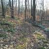
 Devils Den Nature Preserve Perimeter
8.1 mi 13.1 km • 610' Up 185.91 m Up • 618' Down 188.22 m Down

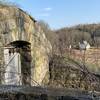
 Zoar Trail
6.4 mi 10.2 km • 1,105' Up 336.9 m Up • 1,105' Down 336.9 m Down
Zofnass Preserve Perimeter
5.9 mi 9.5 km • 607' Up 185.1 m Up • 605' Down 184.4 m Down
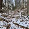
 West Rock Ridge Loop
7.9 mi 12.7 km • 785' Up 239.13 m Up • 772' Down 235.3 m Down
New Haven, CT
Merestead County Park
4.6 mi 7.4 km • 680' Up 207.4 m Up • 689' Down 209.92 m Down
Meyer Preserve Full Perimeter
5.0 mi 8.0 km • 559' Up 170.45 m Up • 559' Down 170.53 m Down


 Minor Issues


0 Comments