
 Continue with onX Maps
 Continue with Facebook


 Particularly Special Place


 Intermediate
Intermediate
Intermediate
 Intermediate
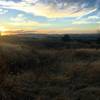
 Las Trampas North Loop
9.6 mi 15.4 km • 2,273' Up 692.77 m Up • 2,300' Down 701.16 m Down

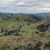
 Elderberry - Rocky View - Cuestas Loop
8.1 mi 13.1 km • 1,397' Up 425.89 m Up • 1,396' Down 425.64 m Down
 Danville, CA
Mount Diablo Four Peaks Loop
Danville, CA
Mount Diablo Four Peaks Loop
15.4 mi 24.8 km • 4,300' Up 1310.69 m Up • 4,298' Down 1309.94 m Down
Clayton, CA
 Ohlone-Crystyl Ranch Loop
5.5 mi 8.9 km • 734' Up 223.87 m Up • 747' Down 227.67 m Down
 Stream Trail Out-and-Back
1.7 mi 2.7 km • 80' Up 24.38 m Up • 80' Down 24.29 m Down
Moraga, CA
Sunol: Flag Hill - High Valley - Little Yosemite
8.5 mi 13.7 km • 1,952' Up 595.06 m Up • 1,950' Down 594.3 m Down
East Fo…, CA


0 Comments