
 Continue with onX Maps
 Continue with Facebook


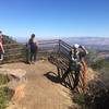
 Particularly Special Place


 Easy
Easy
Easy
Easy
 Easy
Easy
Land Manager: Mid-Peninsula Regional Open Space District
 Mount Umunhum Summit and Back
8.3 mi 13.3 km • 1,195' Up 364.28 m Up • 1,195' Down 364.29 m Down

 Almaden…, CA
Rancho San Vicente Loop
Almaden…, CA
Rancho San Vicente Loop
8.4 mi 13.6 km • 672' Up 204.86 m Up • 672' Down 204.74 m Down
Highland Loop
4.8 mi 7.8 km • 695' Up 211.92 m Up • 670' Down 204.18 m Down
 Henry Cowell Park
8.4 mi 13.6 km • 1,614' Up 491.82 m Up • 1,614' Down 492.03 m Down
Felton, CA
Berry Creek Falls Loop
9.7 mi 15.6 km • 1,844' Up 562.19 m Up • 1,835' Down 559.42 m Down
Boulder…, CA
Skyline to the Sea Trail
25.4 mi 40.9 km • 1,910' Up 582.14 m Up • 4,515' Down 1376.15 m Down
Saratoga, CA


0 Comments