
 Continue with onX Maps
 Continue with Facebook


 Particularly Special Place


 Intermediate/Difficult
Intermediate/Difficult
Intermediate/Difficult
 Intermediate/Difficult
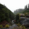
 Lava Canyon Loop
1.2 mi 1.9 km • 257' Up 78.27 m Up • 257' Down 78.34 m Down

 Amboy, WA
 Mount St. Helens Summer Climbing Route: Monitor Ridge
8.8 mi 14.1 km • 4,489' Up 1368.15 m Up • 4,488' Down 1368.04 m Down
Amboy, WA
Loowit Loop
29.4 mi 47.4 km • 5,697' Up 1736.3 m Up • 5,696' Down 1736.19 m Down
Amboy, WA
 Norway Pass
4.3 mi 7.0 km • 849' Up 258.76 m Up • 849' Down 258.75 m Down
Trapper Creek Out-and-Back
7.6 mi 12.3 km • 1,704' Up 519.52 m Up • 1,704' Down 519.49 m Down
Stevenson, WA
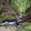
Panther Creek Falls Trail #137
0.6 mi 1.0 km • 87' Up 26.41 m Up • 86' Down 26.32 m Down
Carson, WA


0 Comments