Dogs No Dogs

Features
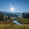
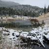
Hot Spring · River/Creek · Views · Wildlife

If you fish the Yellowstone, watch your step. The river here is powerful and fast. If you leave the trail to explore Washburn Hot Springs, be very careful. Backcountry thermal areas do not have boardwalks to protect you, and acidic thermal areas are unstable and extremely dangerous.
Overview
This historical trail skirts the canyon rim, passes Silver Cord Cascade, and plunges more than 1,200 feet into the awesome Grand Canyon to the banks of the Yellowstone River. As the trail descends, it passes interesting thermal features that helped create the canyon. There are several excellent campsites along the Yellowstone River, and the fishing is good too! On the return, take a side trip to Washburn Hot Springs.
Need to Know
This is a great out-and-back to Seven Mile Hole with a 3-mile side trip to Washburn Hot Springs. The round-trip to the Hole without the side trip is 10.2 miles.
Description
The trail begins at the Glacial Boulder Trailhead near Inspiration Point. Glacial Boulder is a 500-ton granite "calling card" left behind 10,000 years ago as the Pinedale Glaciation retreated. It was quarried high in the Beartooth Mountains to the northeast and transported more than 30 miles downstream by a massive river of ice. Geologists have reasoned that glaciers moved across, rather than through the canyon, and had little to do with its carving.
The trail closely follows the canyon rim for 1.3 miles. Many excellent views of the canyon lie just a few yards from the trail. Soon, Silver Cord Cascade's thin strain of white water can be seen as it surges down the far wall of the canyon. Its 1,000-foot drop makes it the highest cascade in the park.
The trail then swings away from the canyon and enters the lodgepole forest. At the 2.8-mile mark a junction with the
Mount Washburn Spur Trail is passed on the left. The trail to Seven Mile Hole continues through the trees another 1/2 mile then begins its steep descent to the river. At times, the trail is very steep and loose scree makes for poor traction. Along the way areas of both active and inactive hydrothermal features are passed. On a sweltering day, with a tinge of sulphur in the air, one can easily imagine descending into hell.
The thermal features are mere remnants of the once extensive hot spring activity here. A fracture zone was created beneath the ground by a huge volcanic explosion 600,000 years ago known as the Yellowstone Caldera. Water and steam percolated up through the fractured ground. Over thousands of years the constant flow severely altered the chemical and physical composition of the hard rhyolite lava. Its normal brown-gray color was transformed into the brilliant yellows and oranges you see in the canyon today. More important, the rock was softened, which allowed the river to erode it and form this awe-inspiring canyon.
At 5.5 miles the bottom of the canyon is reached. It is called “Seven" Mile Hole because it lies 7 miles down river from Lower Falls. This trail was built in 1880 by park Superintendent Norris, who described it this way, "Here, only between Tower Creek and the Great Falls of the Yellowstone, does a bridle-path reach the foaming, white-surfaced, ultramarine blue water of the 'Mystic River' . . . the seclusion, the scenery, and the surroundings of this hidden glen of the Wonder Land render it one of the most uniquely attractive [areas of the park]."
The confluence of Sulphur Creek and the Yellowstone is an excellent spot for lunch or to just lay back and relax. There are also several great campsites in the area and fishing here for large cutthroat is good. Somehow you feel connected to the canyon. Your eyes are drawn up its massive walls. Although the canyon contains more trees here, it is a full 500 feet deeper than at Artist Point and you are in the canyon alongside the mighty Yellowstone!
Once you have enjoyed your stay, retrace your steps to Glacial Boulder. The climb out of the canyon is no picnic, especially on a hot day. Take it slow and pack extra water for this part of the outing. On the way back it is recommended you take a side trip to Washburn Hot Springs. When the
Mount Washburn Spur Trail junction is reached, turn right (not left which returns to Glacial Boulder) and follow it 1.5 miles north to the springs (about half-way you'll pass through a smaller thermally-affected area). Washburn Hot Springs is a collection of highly acidic mud pots, easily found on the left side of the trail. Members of the 1870 Washburn Expedition called this area "Hell-Broth Springs," because it was such an "infernal looking smelling and sounding place." Continuing the satanic nomenclature, individual thermal features in the area were later dubbed the "Devil's Cauldron" and the "Devil's Ink Pot." Climb the hill behind the two big mud pots to see the rest of the basin. But be very careful, acidic thermal areas are extremely dangerous.
Thanks to guidebook author, Tom Carter, for sharing this trail description. To learn more about visiting Yellowstone, check out his book,
Day Hiking Yellowstone.
History & Background
In 1878, Superintendent P.W. Norris explored the Seven Mile Hole area. In 1879 -80, Norris constructed the first iteration of this trail, then called the “Painted Cliff bridle-path.” It and Norris’
Monument Geyser Basin Trail are the first official trails (as opposed to roads) built for tourists to visit an attraction in Yellowstone.
Contacts
Shared By:
Tom Carter

 Continue with onX Maps
 Continue with Facebook


 Particularly Special Place


 Difficult

 Mary Mountain-Nez Perce

 Canyon…, WY
 Specimen Ridge
 Boiling River Trail


0 Comments