Dogs Leashed

Features
Birding · Fall Colors · River/Creek · Spring · Views · Wildflowers · Wildlife


The Grand Gap Trail is also open to mountain bikers on weekdays.
Tent camping near caves, rock walls or rock houses is prohibited by the BSFRA.

Overview

This route provides for a close encounter with the Big South Fork of the Cumberland River by following the river's bank for several miles. It then turns into a steep climb to the top of a bluff where river overlooks provide a big picture of the Big South Fork in panoramic view. On the top of the bluff, it winds through beautiful mountain laurel and hardwood forest. Several overlooks of the river and creek valleys below can be found along the way, including the Angel Falls Overlook and the Fall Branch Overlook. During the spring, the trail is surrounded by wildflowers, from the river's bank all the way around the bluff top.
Need to Know

There is no,water available on top of the bluff. Be sure to carry enough to get you through the 7 miles on top plus plenty for your ascent and descent from Fall Branch.
Although the Big South Fork Recreation Area (BSFRA) backcountry tent camping statement doesn't restrict tent location, it is recommended both by the BSFRA and as a part of good camping etiquette, to camp at locations previously used by other tent campers. This helps preserve the natural flora. Camping near caves, rock walls or rock houses is prohibited by the BSFRA. Existing campsites are at approximately mile 0.1 at the first creek crossing, mile 1 below the trail near the river, mile 1.9 by Falls Branch Creek, and then 0.5 miles on the Grand Gap Trail to the left.
On overnight stays, follow park regulations concerning bear protection, i.e. hang your food, trash, and any aromatic personal hygiene items in a bear bag, or carry bear-proof canisters with you.
Description

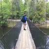
From the Leatherwood Ford parking area, cross the Big South Fork River via the vehicle and pedestrian bridge. After crossing the river, a sharp turn around the bridge structure leads to a stairway down to the
JMT: Leatherwood Ford - Station Camp Crossing.
Follow the John Muir Trail blazes as it meanders along the West Bank of the Big South Fork of the Cumberland River. In the spring, the trail is surrounded by wildflowers to give a colorful journey with some great views of this beautiful river. Follow the river for about 2 miles. Around the 2 mile mark, the trail turns inland, following the beautiful Fall Branch Creek.
At or near the two-mile mark a series of tent camping spots can be seen on the river bank and on the bank of Fall Branch. Consider whether to camp here or whether to try to find a spot on the top of the bluff. If the decision is to camp on top of the bluff, understand that you need to pack enough water on your climb to the top of the bluff to meet your cooking, cleaning and drinking needs for the full time of your stay. There is no water available on the top of the bluff.
By these campsites you'll see signs for the detour around the closed bridge (the bridge is further upstream - you won't see it when you see the detour signs). Follow marked detour rock hopping across the stream - look for flags on the other side then you'll rejoin the trail from the closed bridge. The trail starts its interesting climb of the bluff overlooking the river. The rocky trail leads up and past rock houses (caves or openings in the rock) and sheer rock walls. At one point the trail follows a ledge of a rock wall. A cable support has been installed to help with safely passing through that section. After 0.8 miles, the top of the bluff is reached and the trail continues left while the
Grand Gap Loop Trail to the right.
If you are camping up here, the only developed campsite is approximately 0.5 miles to your left. Describing the route in the counterclockwise direction, head right onto
Grand Gap Loop Trail and continue along the edge of the bluff ridge. Views of the river will be frequently available, including the Angel Falls Overlook. Here, one has a fantastic view of the Big South Fork in two directions.
Eventually, the trail turns in away from the ridge and through a mini forest of mountain laurels. It emerges in a hilly hardwood forest. At around 5 miles, the trail ends at its northern junction with the John Muir Trail, which you'll turn left onto. It passes by the Fall Branch Overlook which offers more wonderful vistas. Visitors will simply need to follow the
JMT: Leatherwood Ford - Station Camp Crossing back to the crossing of the Big South Fork, and their vehicle.
Flora & Fauna

Wildflowers, Mountain Laurel, Rhodedendron, Pines, Hardwoods
History & Background

The Big South Fork Recreation Area, (BSFRA) was established on March 7, 1974 to preserve the Big South Fork of the Cumberland River and its tributaries. It encompasses 125,000 acres and is filled with beautiful gorges and scenic sandstone bluffs.
Contacts
Shared By:
Charles Pulse

 Honey Creek Loop


 Huntsville, TN
 2019 NB100 Training Camp: Day 1


 Oneida, TN
 Natural Bridge Loop


 Jamestown, TN
 Sheltowee Trace NRT: Big South Fork NRA


 Oneida, TN
 Yahoo Falls Loop


 Whitley…, KY
 North & South Old Mac Trail


 Wartburg, TN


0 Comments