
 Continue with onX Maps
 Continue with Facebook


 Particularly Special Place


 Intermediate/Difficult
Intermediate/Difficult
Intermediate/Difficult
 Intermediate/Difficult
Land Manager: California State Parks - Angeles District
 Red Rock Canyon
3.7 mi 5.9 km • 697' Up 212.38 m Up • 697' Down 212.34 m Down

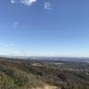
 Parker Mesa Overlook
7.5 mi 12.1 km • 1,469' Up 447.84 m Up • 1,471' Down 448.44 m Down
 Las Flores, CA
Sullivan Canyon Loop
Las Flores, CA
Sullivan Canyon Loop
10.9 mi 17.5 km • 1,518' Up 462.65 m Up • 1,488' Down 453.48 m Down
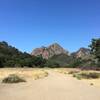
Saddle Peak
9.0 mi 14.4 km • 2,125' Up 647.58 m Up • 2,125' Down 647.59 m Down
Grand Tour
14.8 mi 23.8 km • 2,781' Up 847.79 m Up • 2,784' Down 848.55 m Down
Agoura, CA
Reagan Ranch Loop
3.9 mi 6.3 km • 650' Up 198.08 m Up • 650' Down 198.1 m Down


0 Comments