
 Continue with onX Maps
 Sign in with Facebook


 Particularly Special Place


 Intermediate/Difficult
Intermediate/Difficult
Intermediate/Difficult
 Intermediate/Difficult
Land Manager: USFS - Santa Fe National Forest Office
 Lake Peak and Lake Katherine
17.2 mi 27.6 km • 4,091' Up 1246.82 m Up • 4,082' Down 1244.12 m Down

 Santa Fe Peaks Tour
23.6 mi 37.9 km • 5,920' Up 1804.34 m Up • 5,805' Down 1769.25 m Down
 Ski Santa Fe Loop
13.6 mi 21.9 km • 3,245' Up 988.99 m Up • 3,188' Down 971.61 m Down
 Atalaya Mountain Trail (#170)
6.5 mi 10.5 km • 1,745' Up 531.84 m Up • 1,745' Down 531.83 m Down
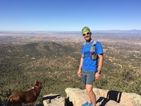
Santa Fe, NM
Atalaya + Picacho Loop
9.6 mi 15.4 km • 2,346' Up 714.94 m Up • 2,351' Down 716.5 m Down
 Main Loop Nature Trail
1.4 mi 2.3 km • 222' Up 67.66 m Up • 223' Down 67.88 m Down
White Rock, NM


3 Comments