
 Continue with onX Maps
 Sign in with Facebook


 Particularly Special Place


 Intermediate/Difficult
Intermediate/Difficult
Intermediate/Difficult
 Intermediate/Difficult
Land Manager: USFS - Santa Fe National Forest Office
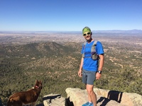
 Picacho Peak from Cerro Gordo TH
3.4 mi 5.5 km • 1,144' Up 348.71 m Up • 1,143' Down 348.43 m Down

 Santa Fe, NM
 Lake Peak and Lake Katherine
17.2 mi 27.6 km • 4,091' Up 1246.82 m Up • 4,082' Down 1244.12 m Down
Raven's Ridge to Lake Peak Loop
10.6 mi 17.0 km • 2,650' Up 807.59 m Up • 2,630' Down 801.54 m Down
Santa Fe, NM
Double Baldy with a side of Redondo
18.8 mi 30.2 km • 4,344' Up 1324.03 m Up • 4,343' Down 1323.65 m Down
Santa Fe, NM
Nambe Lake Out and Back
6.1 mi 9.8 km • 1,716' Up 522.95 m Up • 1,715' Down 522.79 m Down
Santa Fe, NM
 Canada del Buey - Rio Grande Overlook
4.6 mi 7.4 km • 233' Up 71.09 m Up • 234' Down 71.46 m Down


0 Comments