
 Continue with onX Maps
 Continue with Facebook


 Particularly Special Place


 Intermediate


 Intermediate
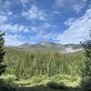
 Buffalo Mountain Loop
13.4 mi 21.6 km • 2,976' Up 907.08 m Up • 2,960' Down 902.3 m Down
Silvert…, CO
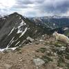
 Ten-Mile Range Traverse
19.0 mi 30.6 km • 7,047' Up 2148.01 m Up • 6,525' Down 1988.74 m Down
Frisco, CO
 Peaks Trail
8.0 mi 12.9 km • 1,213' Up 369.65 m Up • 307' Down 93.49 m Down
Frisco, CO
Pitkin Creek Trail
10.1 mi 16.2 km • 2,924' Up 891.29 m Up • 2,923' Down 891.05 m Down
Vail, CO
 Hassell Lake Trail
2.8 mi 4.5 km • 660' Up 201.15 m Up • 660' Down 201.2 m Down
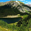
Upper Cataract Lake Out and Back
10.4 mi 16.8 km • 2,510' Up 765.14 m Up • 2,510' Down 764.95 m Down
Vail, CO


3 Comments