Hiking Project Logo

This trail rises from a green meadow up a rocky and sometimes steep trail to the Summit with great views.


Your Rating: Rating Rating Rating Rating Rating      Clear Rating
Your Difficulty:
Your Favorites: Add To-Do · Your List
Zoom in to see details
Map Key

4.6

Miles

7.4

KM

Out and Back

14,033' 4,277 m

High

11,932' 3,637 m

Low

2,178' 664 m

Up

2,178' 664 m

Down

18%

Avg Grade (10°)

59%

Max Grade (31°)

Dogs Leashed

Features Views · Wildflowers

Overview

A great out and back up a 14er, from a less popular trailhead.

Need to Know

There is a small parking area at the trailhead. if it is full, there are pull-off area close by. There are no fees to park. There are also no facilities available.

Description

This route starts in a green meadow with many wildflowers and a small stream. Leaving the meadow begins an ascent through a very rocky area with various cairns to guide the way. The trail becomes less rocky and more defined as you work your way around the mountain and hike toward the saddle. Part of this area is somewhat steep with loose gravel. Part of this section is comprised of switchbacks that make the trail less steep and fairly easy.

As you continue to the saddle the wind will most likely be blowing. On the top of the saddle you'll probably join hikers climbing from the Fairplay side of the mountain. If you are looking for solitude, Mount Sherman would not be the ideal choice. Being considered one of Colorado's easiest fourteeners, there can be quite a few people on the mountain during the summer.

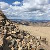
Once at the saddle, you are about halfway to the summit. The trail is well-defined and fairly steep from the saddle to the summit, with many rocks and some loose footing. There is some exposure that some may find a little frightening. We saw several children (pre-teen) coming down this section crying and upset. There are two or three false summits where you may think you are at the top only to find there is more climbing to do. Once at the summit, there is a beautiful 360-degree view of the surrounding mountain ranges.

Follow the same trail back. Watch your footing, but enjoy the beautiful views on the descent.

Flora & Fauna

Many wildflowers in the meadow at the beginning of the hike. There are Marmots in the area posing on the large rocks.

Shared By:

Gary Smith

Trail Ratings

  3.8 from 6 votes

#9

in Leadville

#3837

Overall
  3.8 from 6 votes
5 Star
17%
4 Star
67%
3 Star
0%
2 Star
17%
1 Star
0%
Recommended Route Rankings

#9

in Leadville

#532

in Colorado

#3,837

Overall
3 Views Last Month
926 Since Jul 17, 2020
Intermediate/Difficult Intermediate/Difficult

0%
17%
0%
50%
33%
0%

Photos

Mt Sherman summit
Feb 27, 2015 near Leadville, CO
Mt Sherman summit view
Feb 27, 2015 near Leadville, CO
View on Mt Sheridan from Mt Sherman Trail
Aug 30, 2017 near Leadville, CO
Heading back on the Iowa Gulch Trail with Mount Sheridan in the background.
Jul 24, 2017 near Leadville, CO
Mt Sherman summit looking down the ridgeline
Feb 27, 2015 near Leadville, CO
The final ridgeline ascent to the flat saddle at the top of Mount Sherman.
Jul 24, 2017 near Leadville, CO

0 Comments

Weather


Current Trail Conditions

Unknown
Add Your Check-In

Check-Ins

Jun 18, 2021
Jeff S
4 even, 2:05 to summit, Mud, windy summitt — 4h 00m
Sep 26, 2020
Rachel Solorio
1.2mi
Jul 15, 2020
Gary Smith
Probably the slowest time ever recorded for this hike. I beautiful day and a nice hike with great views. Very windy. 5.3mi — 6h 40m
Jul 10, 2020
Robert Whalen
4.4mi — 3h 49m
Sep 2, 2019
Stephen F
Welcome

Join the Community

Create your FREE account today!
Already have an account? Login to close this notice.

Get Started