
 Continue with onX Maps
 Continue with Facebook


 Particularly Special Place


 Intermediate

 Intermediate
Land Manager: Town of Cedaredge
 Flowing Park Loop
14.9 mi 24.0 km • 527' Up 160.64 m Up • 525' Down 160.17 m Down
 Cedaredge, CO
 Grand Mesa Crag Crest Loop
10.9 mi 17.6 km • 1,521' Up 463.69 m Up • 1,540' Down 469.29 m Down
Cedaredge, CO
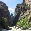
Gorge(ous) 10-miler Loop
10.2 mi 16.4 km • 1,759' Up 536.26 m Up • 1,758' Down 535.96 m Down
 North Vista Trail
6.7 mi 10.8 km • 1,169' Up 356.18 m Up • 1,169' Down 356.24 m Down
Olathe, CO
 Long Draw (Gulch)
1.8 mi 2.9 km • 1,422' Up 433.33 m Up • 1,422' Down 433.34 m Down
Montrose, CO
Palisade Rim Trail
8.8 mi 14.2 km • 1,514' Up 461.39 m Up • 1,515' Down 461.72 m Down
Palisade, CO


0 Comments